I am a non-dancing Scottish Country Dancer. I gave up dancing in 2020 due to a heel issue, Haglund’s Deformity. After struggling with it for five years, I gave in and had surgery on the heel this past January.
There will always be a part of me that continues to have the heart of a Scottish Country Dancer. I maintain my membership to the San Diego and the International Branch in Scotland. I have helped out at events. This weekend I went to the San Diego Highland Games to support the local Scottish group, to have fun, and help out at the booth.
The Highland Games are traditional Scottish sporting and cultural festivals that feature heavy athletics, piping, drumming, and Highland dancing. Originating centuries ago in the Scottish Highlands, they serve as a vibrant celebration of Celtic identity and are now held globally
I enjoyed being at the booth, speaking with people who came up to ask questions. Once in a while, a face from the past showed up. Sometimes I remembered them, and sometimes I didn’t, yet it is always fun to greet people, reconnect, and hear their stories. One man told us that he Scottish danced years ago until a heavyset dancer stepped on his foot and broke it. Ouch! (Trust me, that is a rare event)
Yesterday, two men, a father and son, showed up at our booth from the Santa Rosa Branch of the RSCDS. Santa Rosa is north of San Francisco. Ethan was competing in the solo Bag Piping event.
Look at that Blue Kilt
In 2013, I wrote a post about Jim’s kilt, a Modern Morgan plaid. I gifted it to an organization created by a good friend, Ron Wallace. Ron is a gifted dancer, musician, and teacher. This organization was created as a non-profit to help young Scottish musicians and dancers be able to outfit themselves. Instruments cost money. Kilts cost money. Often it takes time for young musicians and dancers to outfit themselves. Jim’s kilt is still helping these young men to perform in the correct attire until they can afford their own.
Today at the Highland Games, I met the “Baily Boys” a father and son, Bill and Ethan, who dance in Ron’s class in Santa Rosa, California. The son is also a piper, learning his art from Ron among other teachers.
Ron
I have not been in touch with Ron for quite some time. I took the time to ask the Baily Boys for an update on Ron’s phone number and e-mail. This is when I found out that Ethan had worn Jim’s kilt as he was beginning to perform.
Here is what I feel is odd. Jim has been gone for over thirteen years. My life has certainly taken on a new direction. Knowing that Ethan had worn Jim’s kilt brought me to tears, and my heart felt full. It was such a touching moment to learn that Jim’s kilt, like his memory, are living on.
I was surprised that knowing this one fact opened my heart. It felt like I was seeing Jim and this kilt and all those who might have used it since his death. My heart flooded open, and I felt so grateful to know that this nice young man had benefited from a kilt that I gave to this organization. It was an honor to meet him, to know he had shared a little piece of Jim and then shared it with me.
For a moment, it made me wish I could go back in time and stand next to Jim once again as we went to our next ball. Sigh. I wonder if this will ever go away. i wonder if I want it to.
Grief is such an odd thing. It seems to take so many shapes and forms. Sometimes it involves the feeling of loss. Sometimes I see that time in my life as if it was a moment so long ago and yet still so close. And, sometimes, like today, it fills me with so many emotions all at once. Love, remembrance, sadness, tears, longing, joy, a very full heart, being in the moment, and everything else in between.
And, you know, I am glad I can feel all these things. I am glad I can be brought into the moment, where the past and future and even the present seem to fade away. And for that one moment I can truly experience being here now, being in this one moment. I can once again understand and know at a core level what I had with Jim and feel grateful that I had this experience for twenty-one amazing years.
Thank you to Ethan who helped bring this moment forward. Thanks to a Modern Morgan plaid kilt that keeps on giving to me and others. There is magic in that material. Thanks to Ron who helped that kilt find a good home. And…thank you to Jim who keeps on giving my heart a tug, over time. I love him still.
Today I am thankful. I am thankful for a full heartfelt moment. I am thankful for memories that make my heart and spirit so full.
Time on the islands of Croatia never feels long enough. With the warm sunny days and the beautiful blue Adriatic Sea, it feels like I could spend more time on each of the islands I have visited. But wait…there are more islands to visit. I guess I will have to return.
A true hedonism has been present on the island of Hvar, ever since the time of sumptuous Roman villas, springing from the walls of Renaissance summer houses, and, despite all the challenges of island life, it slips even today into the reveries of modern nomads who enjoy the splendor of Hvar, where, 157 years ago, organized European tourism began.
As one would expect on an island, the history of Hvar has been broadly shaped by outsiders, each invading force leaving its mark, resulting in a rich cultural, archaeological, and architectural legacy.
The earliest signs of civilization on Hvar date back to Neolithic times and the so-called Hvar Culture of 3500 – 2500 BC.
Given its prominent position on a busy sea route, it is perhaps surprising that the island was not settled earlier than 384 BC, when the Ancient Greeks founded the settlement of Pharos (modern-day Stari Grad). The Ionian Greeks, the Parans, were in search of a base for military and trade expansion, and the deep bay at Pharos offered the best protection.
The first recorded naval battle in the Adriatic took place just off Hvar, with the Greeks successfully taking on the native Illyrian tribe of the Liburni.
With the decline of the Syracuse Empire, Pharos enjoyed a brief period of local rule under Demetrius of Hvar, who kept the Romans at bay until they finally smashed the walls of Pharos in 229 BC. The Romans used the island as a strategic and logistical base, keeping their boats in the protected bays of the Scedro and the Pakleni Islands. Roman holiday houses sprang up in the bays close to fresh water, most notably in Hvar, Stari Grad and Jelsa. Archaeological finds confirm that the islanders were engaged in wine growing, fishing, and trade.
There is little recorded about Hvar after Roman rule, but the island, along with the surrounding islands, was under the Croatian state of the Neretljani in the early Middle Ages before being briefly occupied by Venice in 1147. This was only temporary, however, as Croatian-Hungarian King Bela III managed to bring Dalmatia under his rule.
The Venetians were back in 1278, having been invited back by the islanders looking for protection from the pirates of Omis. One of the early changes the Venetians introduced was moving the central administration from Stari Grad to Hvar, and the new center became a regional administrative center for Hvar, Vis, and Brač. A plan to build walls around the town and monastery was initiated in 1292.
Venice’s rule was far from secure, and the island’s noblemen rebelled in 1310. Hvar’s rulers changed several times (Croatian-Hungarian kingdom, Bosnian kingdom, and Dubrovnik) before, along with the rest of Dalmatia, a more protracted period of Venetian rule from 1420 to 1797.
Hvar became the main Venetian port in the eastern Adriatic, but was under constant threat of attack from the Turkish fleet, which controlled the mainland near Makarska. A devastating Turkish naval attack in 1571 under Algerian commander Uluz Ali in 1571 laid waste to Vrboska, Stari Grad and Hvar.
Hvar prospered under Venetian rule and was known for wine, lavender, olives, rosemary, fishing, and boatbuilding. More than three centuries of Venetian rule came to an end in 1797, when the Austrians briefly took over before being themselves usurped by the French. The Russians bombarded Hvar in 1807 in a period of general instability and warfare in Europe, until the Austrians retook control in 1813, a rule that lasted into the 20th Century.
Austrian rule was stable and brought prosperity, most notably in the development of health tourism on the island, with the founding of the Hvar Hygienic Society in 1868. The oldest meteorological station in Croatia was also established in 1858. Austrian rule also brought infrastructure improvements to the island, including the rebuilding of all the ports, the construction of new lighthouses, the reclamation of malaria-infested marshland, and the construction of a road connecting Jelsa to Pitve and Vrisnik in 1907.
The Italians were back in November 1919, occupying Hvar once more after fierce fighting, an occupation which lasted until the 1921 Treaty of Rapallo consigned the island to membership of the Kingdom of Serbs, Croats and Slovenes, later the first Yugoslavia and then the Socialist Federal Republic of Yugoslavia.
Hvar’s latest (and one would hope permanent) change of master occurred on January 15, 1992, when Croatia was recognized as an independent state.
The former Yugoslav army (JNA) attacked Croatia in July 1991, and Hvar was blockaded the following month. The main effects of the blockade were shortages of foodstuffs normally brought from the mainland, such as flour, and a lack of access to hospitals and other medical services.
A ceasefire was signed, and the navy left Sucuraj territorial waters on December 3, 1991.
St Stephens Square
The situation on the ground in the mainland was dire, with large tracts of Croatia occupied. A steady stream of refugees had to be housed, and a logical supplier of beds was Hvar, devoid of tourists due to the conflict. Refugees, particularly from the front-line town of Vukovar, began to arrive by boat.
The refugee situation deteriorated in 1992 as Croatia took in numerous refugees from the brutal war in Bosnia and Hercegovina. The effect of traumatized refugees replacing affluent tourists was twofold: a severe reduction in revenue and a severe increase in wear and tear in the hotels.
A UN fact-finding mission in August 1992 found that there were 624 displaced persons and 3,727 refugees on Hvar, of whom 1,323 were in private accommodation, the rest in hotels. Usually closed in winter, most of the hotels had no heating installations, which caused problems for the new temporary residents.
With the demographic balance upset in both directions – an increased population during the winter and a decrease in the summer due to a lack of tourists – the hotels were full year-round, which had a negative impact on the condition of the buildings.
The absence of many paying visitors had a devastating effect on the island’s economy, leading to the closure of many cafes and restaurants.
The cafes & restaurants closed due to a lack of electricity (from the occupation of the Peruca dam, the source of hydroelectric power) and difficulties obtaining necessary goods such as coffee, milk, etc., from the mainland. Many of Hvar’s male population were drafted into the defense forces on the front line near Zadar, where one man from Stari Grad was killed, and many more returned suffering from PTSD.
Thankfully, both Hvar and Croatia have recovered well from those dark days. A highly successful marketing campaign under the slogan, Croatia, the Mediterranean as It Once Was, proved very effective, and a new generation of tourists joined the returning older generation to discover the magic of the Adriatic. Hvar was named one of the 10 most beautiful islands in the world by Condé Nast readers back in 1997, and it has never looked back. Major investments in the town’s hotels and the upgrading of cultural treasures such as the Arsenal and the oldest public theatre in Europe has meant that Hvar is once more a major luxury tourism destination on the Croatian coast.
HvarThe FortressFortress on the Hill & HvarSt Stephen’s square
A trail from Hvar leads to Napoleon’s fortress, built in 1812 on top of a 230-meter-high hill above the town of Hvar. Today, Napoleon’s Fortress is home to the Hvar Observatory. The research office is dedicated to astrophysics and has the largest star telescope in Croatia with a one-meter mirror. The trail from Hvar leads along a narrow, steep path through a beautiful pine forest to Napoleon’s Fortress. The fort offers a beautiful view of the town of Hvar and many nearby islands, such as the Pakleni Islands, Vis, Brač, and Solta.
We did not have time to visit this fortress while we were there. The stairs looked daunting, and we had excursions while on the island. I would go back just to explore this Fortress.
The first evening included a sunset sail and swim. The water was not as warm as I expected. Our captain told us to give it a few more weeks, and it would be warming up for the influx of tourists in the busy season, July and August.
Our first full day, we took a high-speed boat tour to the outer islands, including the island and town of Vis.
In 397 BC, Dionysius the Elder, ruler of Syracuse, founded the colony of Issa, known today as Vis.
And like many other posts on my blog since my arrival to Turkyie the history of Vis is of the rise and fall of empires.
Much like the surrounding islands and area, Vis fell to French and then Austrian control. However, following the Battle of Lissa in 1811 (between the British, the French, and the Venetians), British bases were established on the island, including George’s Fortress. As part of the Austrian Empire, Vis became a naval base and was strategically important in a sea battle between the Austrians and Italians in 1866 (with Croatians making up a large number of the sailors on Austrian ships).
Look at that Blue WaterThe Town of VisChurch of Our Lady of the Pirates
During World War II, Vis was the hiding place of partisan/resistance leader Josip Broz Tito, who became leader of Yugoslavia after WWII. During this war, Vis was also a major base for British and Allied troops – there is a British military cemetery on the island. Allied fighter planes were also based there.
A sign in front of a cave on Vis marking the fact that Tito – leader of the Yugoslav Partizan resistance movement during World War II – stayed and worked here in 1944
After 1945, Vis was closed to tourism by the Yugoslav army as it was used as a major naval base. The pictures below show bunkers on the island. They also had a hidden water bunker for any captured submarines.
It was reopened to foreigners only in 1989 and was part of Croatia, which gained independence in 1991. All the navy/military buildings on the island were abandoned at that time, although many of them can be visited today – including the cave in which Tito ‘hid’ in during World War II.
It was a full day of traveling and swimming. I took time in the evening to do what so many others do in Hvar. I walked the waterfront, and people watched. Hvar felt very much like a Mediterranean seaside resort. Don’t misunderstand me, there was so much history here to unravel and understand. But sitting in the main square and on the walkways on a Saturday night was truly a fashion extravaganza. Women were dressed in long luxurious summery gowns, and the men were in full suits. It was such a parade. I enjoyed strolling, sitting, and watching as the parade of people unfolded before me.
The last full day on the island, Zee and I went on a guided kayaking tour. Crossing the main channel from Hvar to the Pakslinski Islands was rough. Waves were coming in one direction, and the wind was blowing from the opposite direction. Big ferries and boats came zipping past. I was pretty exhausted by the time we arrived back in Hvar later in the day. It was quite the ride. Once again, we had this knowledgeable young guide with us who knew so much about Croatia’s history.
Our Day Kayaking the Pakslinski Islands
After a busy time on this island, we had to say farewell. There was so much to see here and the time felt short. But wait…There are more islands to visit, so sadly we had to say farewell to this island and the people who made it so special.
I realized today that in each place we have visited in Croatia, I have met the nicest people. They are from all over the world. It has helped that most have spoken English. Most people in Croatia begin learning English in grade school.
Enjoy the travel log; as my trip comes to a close, there will be only a few more posts. I hope that you have enjoyed the photos and stories of this trip.
Zee and I arrived in Croatia three days ago. It is very different than Türkiye. It is more modern, we don’t see any of the squatty potties we saw throughout Türkiye, more people speak English and it just feels esaier to move around.
For three days we stayed in Split a small town centered around a Palace, the Diocletian Palace. The history of the city of Split is inextricably linked to the Roman emperor Diocletian and his stunning palace which was built for the purpose of his retirement in the year 305.
Diocletian’s palace is one of the best preserved and most impressive monuments of the Roman era in Europe, and it has been on UNESCO’s World Heritage List since 1979. The palace was built to serve several purposes and combined imperial residence, a military fortress, and a fortified town. Even though its original structure changed and altered over the centuries, it is still, even today, the very heart of the city of Split packed with bars, restaurants, shops, and people wandering around, absorbing the vibrations of the streets.
Diocletian was born around the year 243 in Roman Dalmatia, probably somewhere near Salona, with the name Diocles. He began his career as a soldier, defending the distant borders of the Roman Empire and conquering new ones. Diocletian was proclaimed emperor in the year 284 with the title The Emperor Gaius Aurelius Valerius Diocletianus. He ruled for twenty years, which was a relatively long time at that period. He abdicated voluntarily and retired to the palace he had built in his Dalmatian homeland. At that time, the ancient settlement of Aspalathos, Latin Spalatum, was known as a small fishing port and had no possibility of advancement due to the great development of nearby cities, such as Salona and Trogir. The situation changed after Diocletian decided to spend the last days of his life precisely in Spalatum.
It is assumed that the construction of the palace lasted for 10 years. Diocletian’s palace was a very strong fortress that occupied an area of more than 30,000 m². It was constructed with stone transported from the island of Brač, in addition to marble from Italy and Greece, as well as the columns and 12 sphinxes from Egypt. The palace actually contained an entire city with streets, squares and buildings that served different purposes. The southern façade of the palace was located right on the coast. The other three facades were located on land and together with the southern façade closed the rectangular shape of the palace.
Golden Gate
The Palace was divided into four parts by the two main streets intersecting in the middle: the guards and military were situated in the northern, while Diocletian’s residence was in the southern quadrants. Each wall of the palace had a gate at its center, named after a metal: northern Golden Gate, southern Brass Gate, eastern Silver gate, and western Iron Gate. In ancient times, Brass Gate opened straight from the water into the palace basements, enabling goods to be delivered directly from the ships and stored there. Today, Brass Gate is the main entrance into the palace from the Riva.
After Diocletian died, his Palace became imperial property. At the beginning of the 7th century, after the devastation of nearby Salona, Diocletian’s palace provided shelter to the exiled inhabitants who were defending themselves from the invading barbarians. This period also marked the beginning of organized city life inside the Palace. During the following centuries, the area of the city of Spalatum expanded and parts of Diocletian’s palace were destroyed, while other structures were built inside it. The city gradually spread around the Palace and by the 15th century, it doubled in the surface. Today, Split is the largest city in Dalmatia and the second-largest city in Croatia.
The Silvert Gate
The terraine here reminds me very much of southern California. It is a mediterranean climate so it should not surprise me that things look a lot like where I am from. On one of my adventures through town I found a massive Bougainvillea. Many of the flowers are the same as well. What is very different is the very blue Adriatic Sea.
The Second day we signed up for a tour that lasted for most of the day. We visited the UNESCO world heritage site, the town of Trogir and then prceeded to one of Croatia’s National Park, Krka Falls. It was a fascinating day with a bit of diversity in it, from town to nature and back again.
The Historic City of Trogir on the eastern coast of the Adriatic is a remarkable example of urban continuity. The orthogonal street pattern of this island settlement dates back to the Hellenistic period, and it has been embellished by successive rulers with many fine public and domestic buildings and fortifications. Its fine Romanesque churches are complemented by the outstanding Renaissance and Baroque buildings from the Venetian period. Its urban fabric has been conserved to an exceptional degree and with the minimum of modern interventions, in which the trajectory of social and cultural development is clearly visible in every aspect of the townscape.
The ancient town of Tragurion was founded in the 3rd century BC as a trading settlement by Greek colonists on an island at the western end of the bay of Manios between the mainland and one of the Adriatic islands. The town was enclosed by a megalithic wall and its streets were laid out on a grid plan. The town has been in continuous occupation since then. Its contemporary plan reflects the Hellenistic layout in the location, dimension and shapes of its residential blocks. The two ancient main streets, the cardo maximus and the decumanusare still in use.
The development of the ancient town is clearly expressed in the town plans. Ancient Tragurion lies at the eastern end of the islet; this spread out in the earlier medieval period, and the plan of two concentric circles of houses and streets, within the former walls, is still visible. The medieval suburb of Pasike developed to the west on a different alignment, and was enclosed by the later fortifications. The port was located on the south side. Finally, the massive Venetian fortifications incorporated the Genoese fortress known as the Camerlengo. The townscape of Trogir is determined by the pattern of, for the most part, narrow streets. Its homogeneity is stressed by the predominant local limestone, now mellowed by time with a golden patina.
The Krka National Park has held national park status since 1985 and is one of the most popular and well known of Croatia’s many natural attractions.
Being barely spoilt by humanity, this large expanse of 109 square kilometres is wild and attractive, boasting the highest density of wild lavender in Europe and sustains a variety of eco-systems.
Nearly 900 different plant species live within the park, as well as over 200 bird species and 18 different types of fish from trout to the Dalmatian Barbel Gudgeon.
The national park is also home to some of the most impressive waterfalls in the country.
At the end of the day we took a twenty minute boat ride to the town of Skadin before we returned to Split. It was a full day and a good day. As I walked along the boardwalk trails I enjoyed listening to the frogs and birds. It was nice to be in nature for a part of my day. Nature is always so important for my healing self.
Today it has been raining, thunder, lightning included for free. We took the boat to Bol. for two nights and now will be on some of the Croatian Islands before ending the trip in Dubrovnik in about 10 days. Stay tuned there is more to come.
And they are still loved and protected in Croatia. They have been loved and cared for since the plague. It was discoved if you had cats around the rats were killed. No Rats – No Plague. Yay kitties.
Well it has been an action-packed two weeks. When traveling with a tour group, one is on the move. I have seen a lot of Turkyie and reawakened some ancient world history.
Before I get on the plane, I wanted to share some photos of the last places I have been since I last posted.
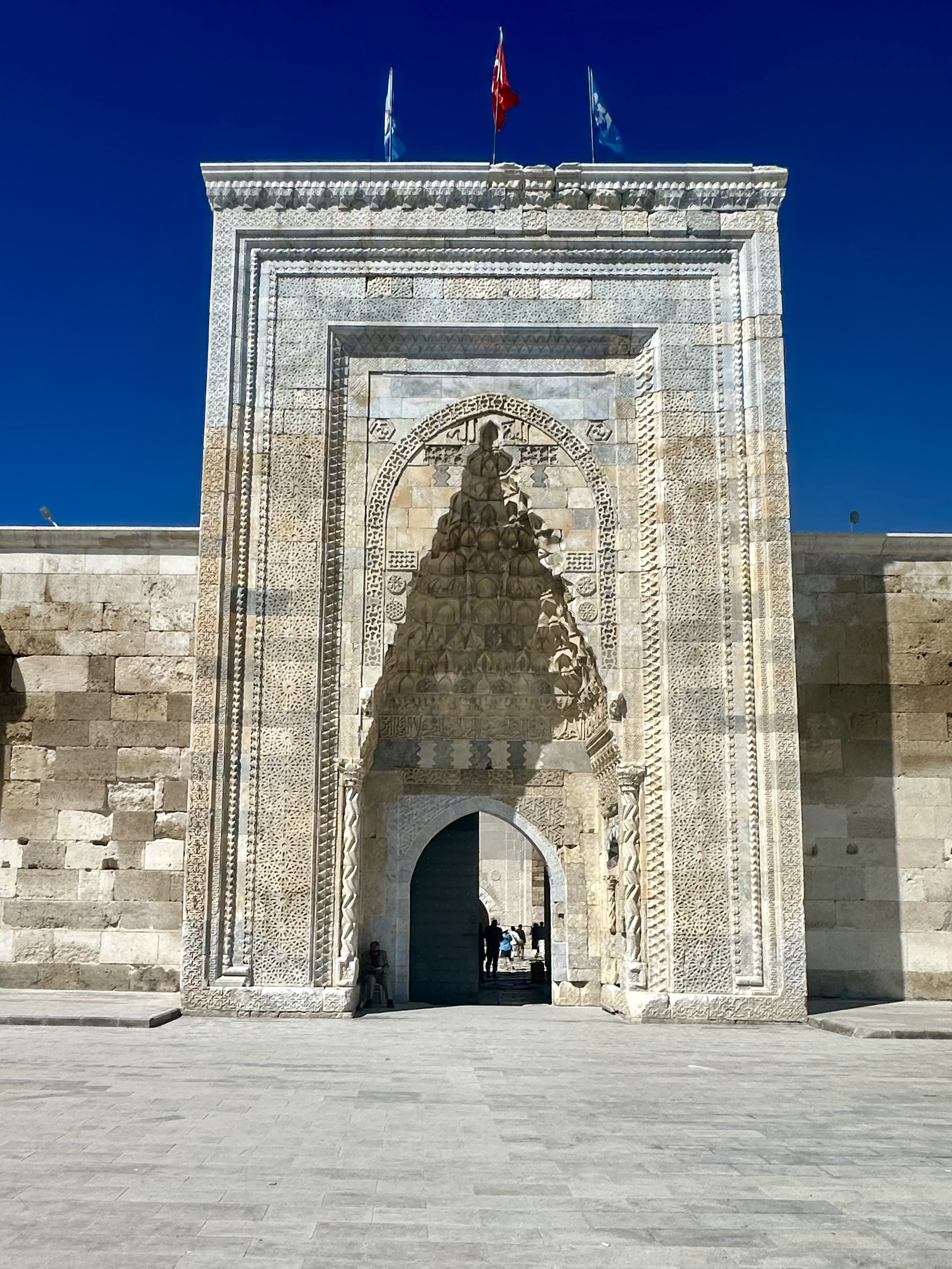
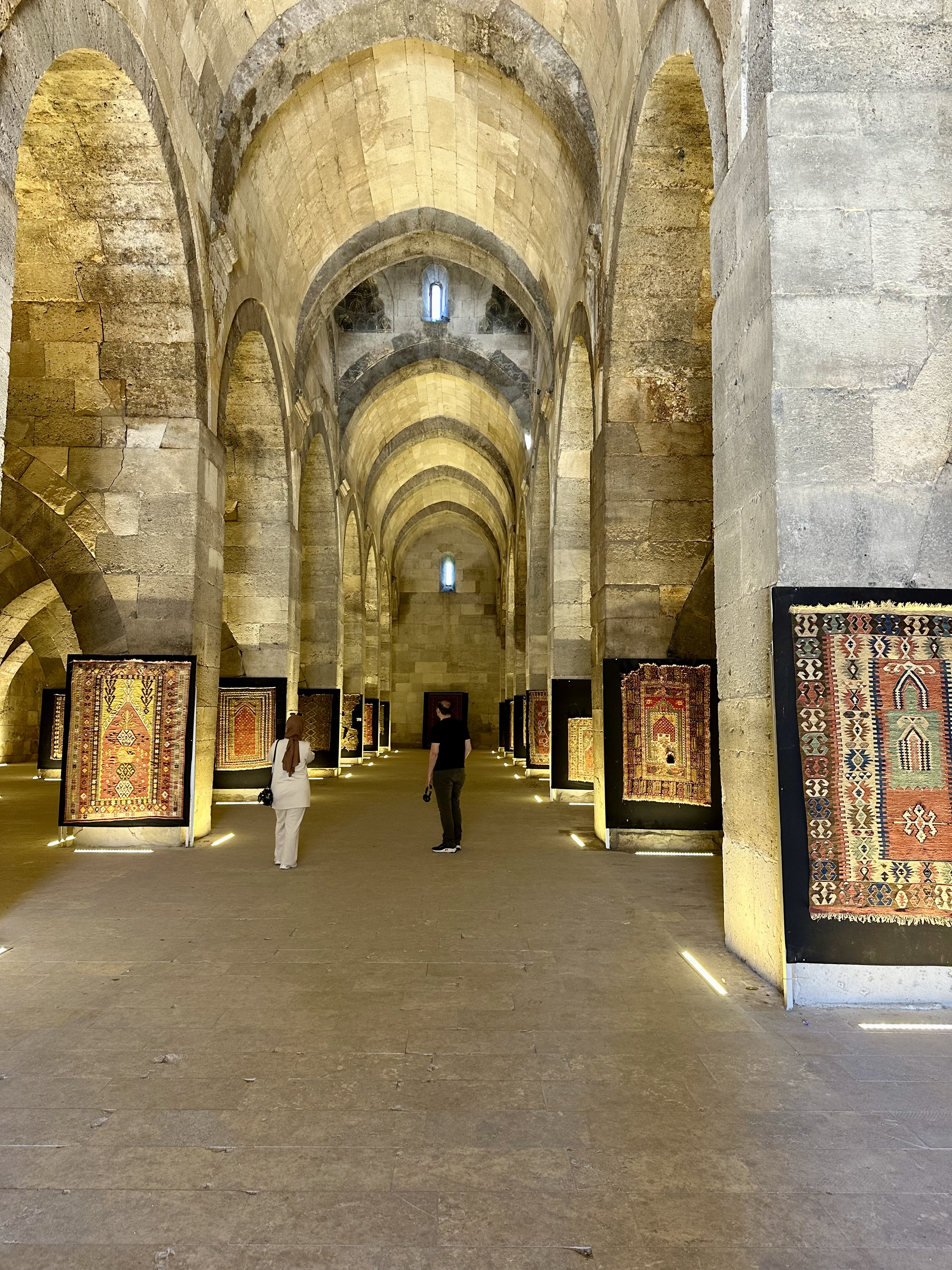
First stop was on the Silk Road at a Caravanserais. Hmmm…What is that?
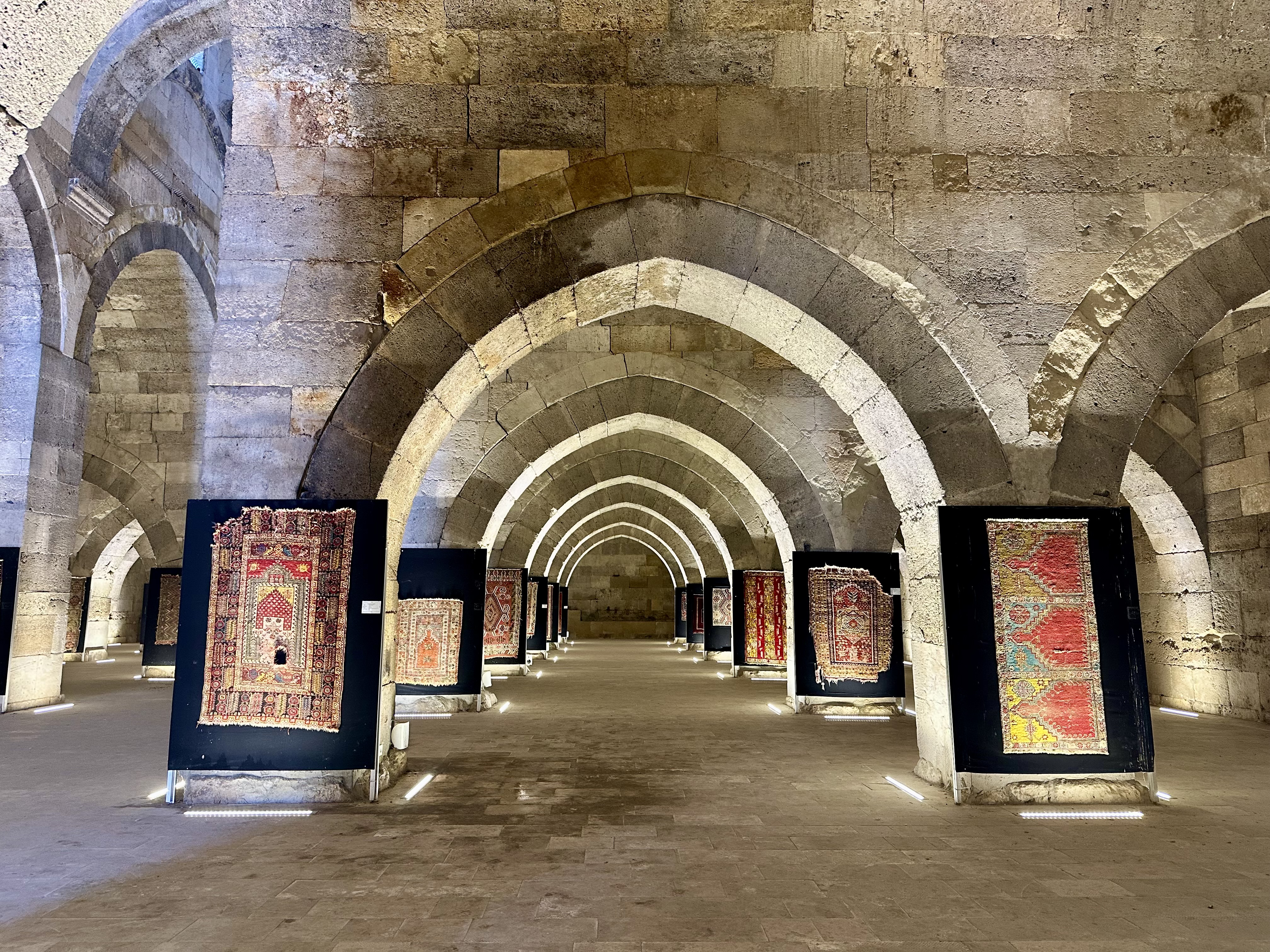
The site, formally known as Sultan Han, is widely regarded as one of the finest surviving examples of Seljuk-era architecture anywhere in the world, and carries the additional distinction of being the largest caravanserai still standing in the entire country — covering approximately 4,900 square metres, which is a considerable amount of 13th-century stonework by anyone’s standards. It was built between 1229 and 1236 on the orders of the Seljuk Sultan Alaeddin Keykubad I, who had apparently decided that the 300-kilometre stretch of road between Konya and Aksaray needed a decent pit stop, and wasn’t going to do things by halves.
The word han translates roughly as “inn” or “hostel,” which rather undersells this place. Caravanserais like this one were the essential infrastructure of the medieval trading world — vital stopping points along the great overland routes of the age, including the Silk Road, that extraordinary network of tracks and paths connecting China and Central Asia to the Mediterranean and beyond. Merchants travelling these routes were shifting silk, spices, ceramics, glassware, and every other commodity you care to mention across thousands of miles of difficult and often dangerous terrain. They needed somewhere to stop, eat, sleep, water their animals, and repair their equipment. Sultan Han provided all of that, and at the Seljuk Sultan’s express instruction, it did so entirely free of charge for the first three days of any traveller’s stay. Three days. Free food, free lodging, free stabling. The medieval equivalent of an extremely generous service station.
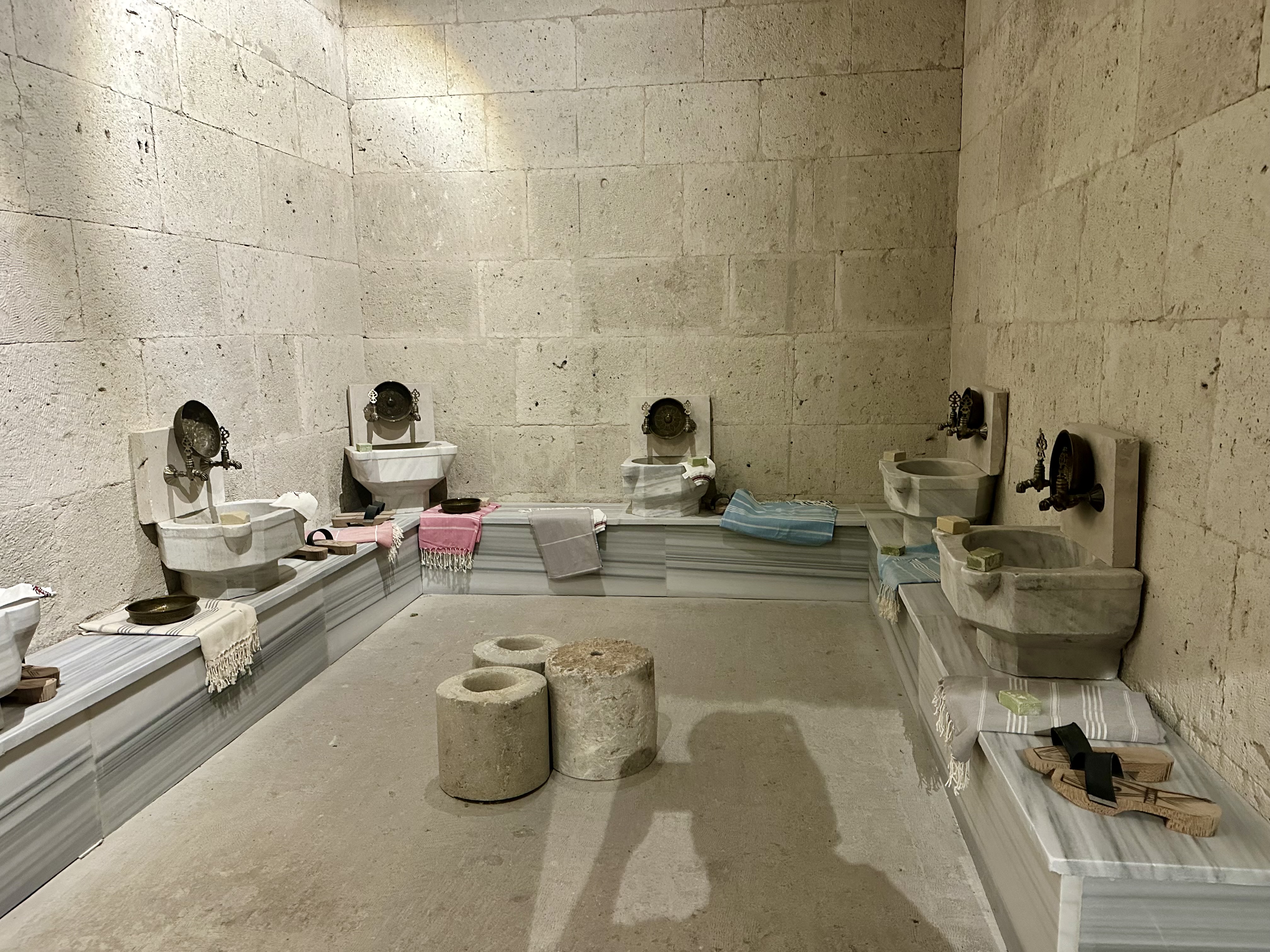
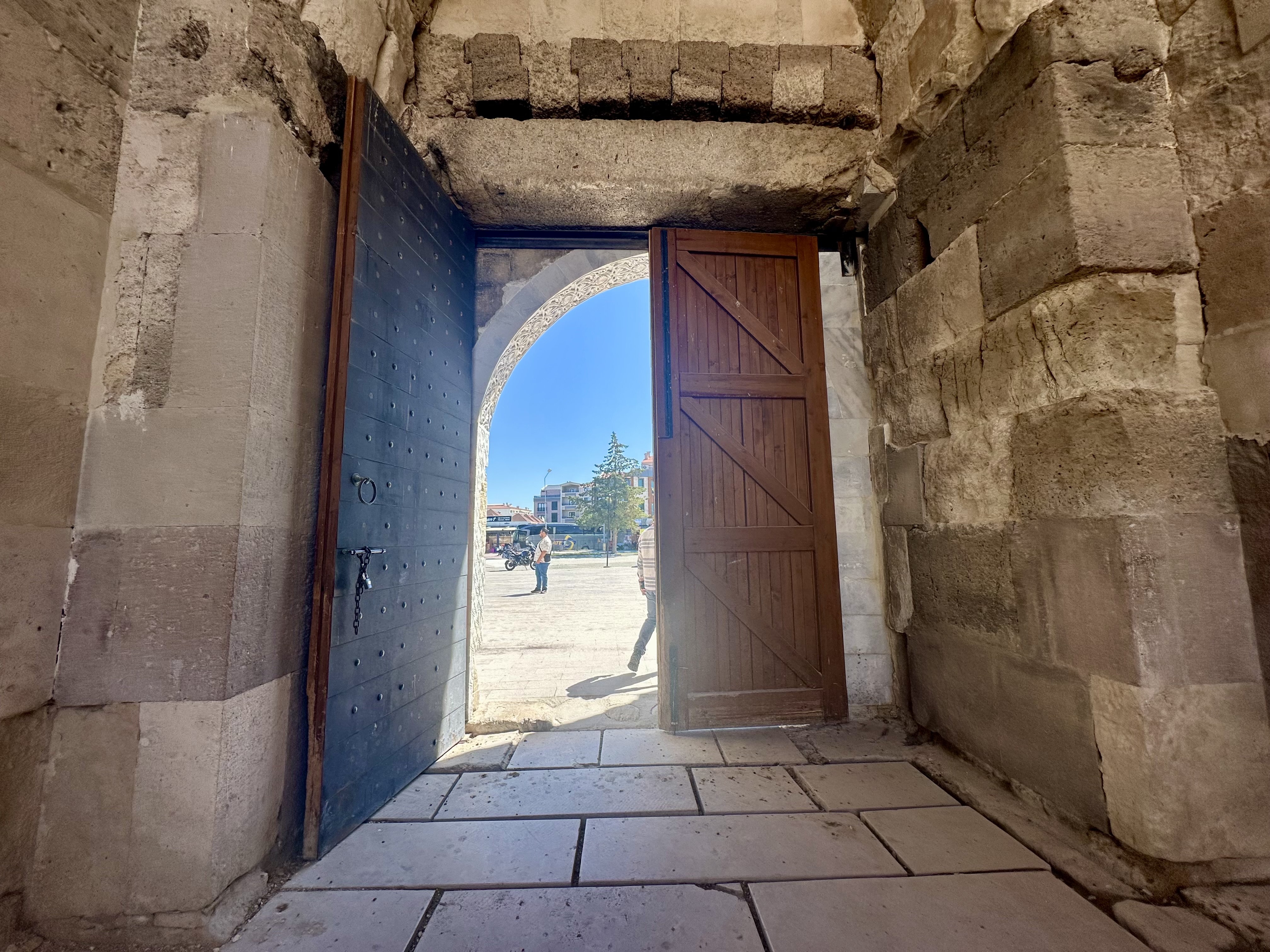
In practical terms, these structures were simultaneously inns, warehouses, stables, bathhouses, mosques, and fortresses. The fortress element was not decorative — travelling merchants were carrying valuable goods through remote and occasionally lawless territory, and the thick stone walls and single heavily guarded entrance were there for very good reason. The Seljuk Sultanate of Rûm, which controlled much of Anatolia during this period, built a string of caravanserais roughly a day’s journey apart — approximately 30 to 40 kilometres (about 25 miles), a camel’s ride length— specifically to encourage and protect trade.
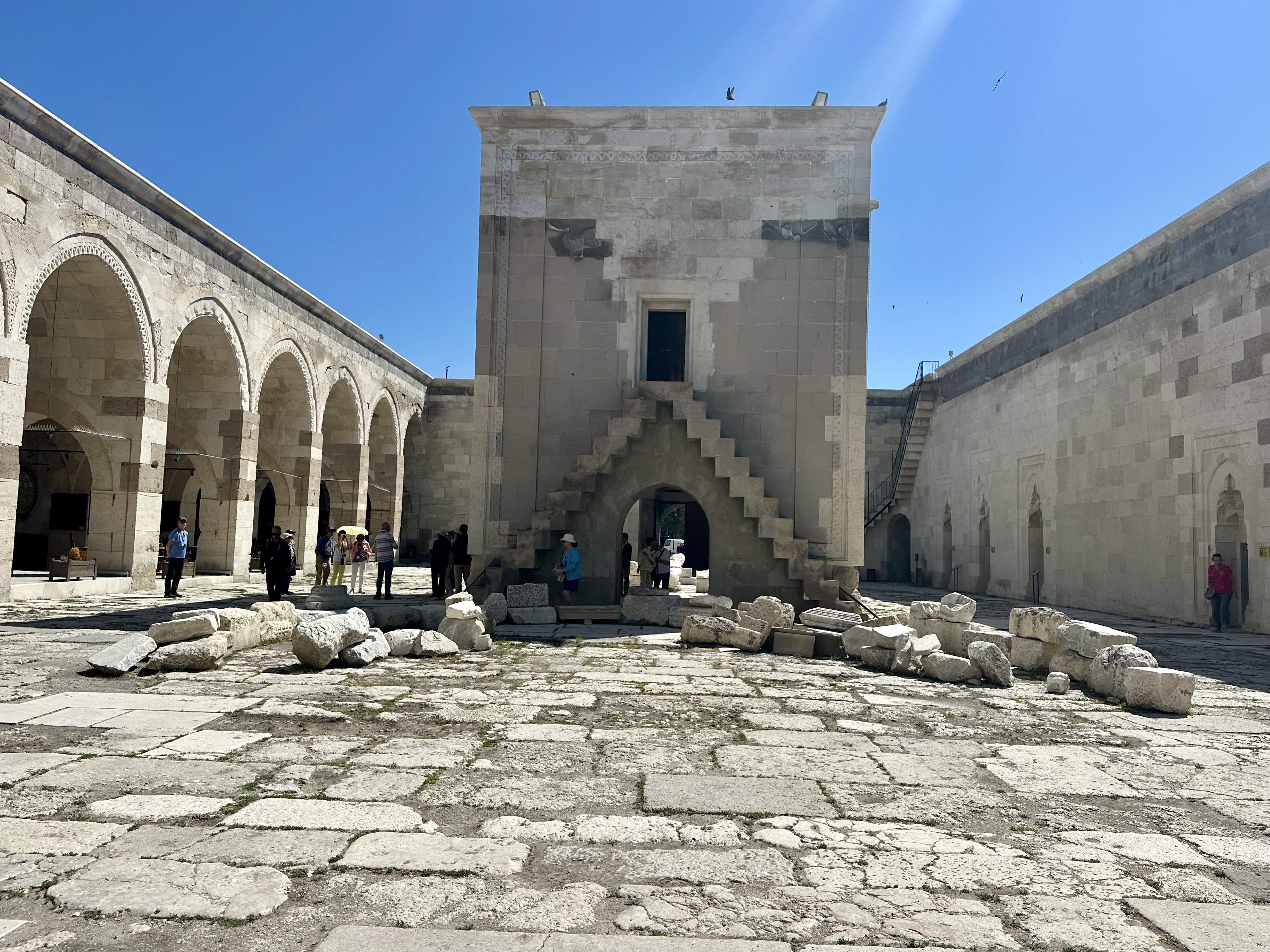
EntranceInterior CourtyardThe Winter RoomSultans RoomTurkish BathReturning to the Outside World
Once through the entrance, this courtyard would have been absolutely heaving with life. During the warmer months, traders arriving along the old caravan routes would have bedded down here alongside their camels, horses, and whatever else they’d dragged across the desert. It wasn’t glamorous, but then neither is a Premier Inn, and at least here you could see the stars.
One side of the courtyard is lined with a covered arcade — a shaded walkway of the kind you find all over the ancient trading world, designed less for aesthetic charm and more for keeping the sun off your head while you argued about the price of silk.
It’s generally believed that this arcade area originally served as stabling for animals or storage for goods — the kind of unglamorous but essential infrastructure that kept the whole trading system ticking. Nobody builds a plaque for the horse stalls, of course, but without them the merchants would have got precisely nowhere. Over the centuries, as the caravans stopped coming and tourism quietly took their place, the space was repurposed. It’s a practical reuse of what was there, and to be fair, it doesn’t feel cynically commercial — more like a sensible acknowledgement that the world moves on and people still need somewhere to sit.
As a reminder of the Caravan Days today next to the site is a small shopping area with a cafe. You can buy many things there but tea and ice cream are still a favoriite.
Next it was on to Cappadocia the place of the Cave Houses and Churches with a history that goes way back.
The cave houses of Cappadocia, carved directly into the soft volcanic tuff of central Anatolia, have been continuously inhabited for thousands of years. Originally adapted by ancient civilizations as basic shelter, they later served as safe havens for persecuted Christians before evolving into today’s sought-after boutique hotels.
Hittites & Phrygians (circa 8th–7th Centuries BC): Early inhabitants of the Anatolian plateau began carving basic structures into the soft volcanic rock for seasonal storage, wineries, and simple dwellings.
Geological Advantage: The landscape’s “fairy chimneys” are made of volcanic tuff, which is remarkably easy to carve with basic tools, yet hardens into a strong, insulating material when exposed to air.The cave houses of Cappadocia, carved directly into the soft volcanic tuff of central Anatolia, have been continuously inhabited for thousands of years. Originally adapted by ancient civilizations as basic shelter, they later served as safe havens for persecuted Christians before evolving into today’s sought-after boutique hotels.
The Origins: Ancient Civilizations
Hittites & Phrygians (circa 8th–7th Centuries BC): Early inhabitants of the Anatolian plateau began carving basic structures into the soft volcanic rock for seasonal storage, wineries, and simple dwellings.
Geological Advantage: The landscape’s “fairy chimneys” are made of volcanic tuff, which is remarkably easy to carve with basic tools, yet hardens into a strong, insulating material when exposed to air.
Kayakapi Premium Caves – Cappadocia
The Byzantine Era: Monasteries and Refuge
Early Christians (4th Century AD onward): During the Roman Empire and subsequent Arab-Byzantine conflicts, Christians facing religious persecution sought refuge in the region.
Underground Cities: Locals expanded the cave systems into massive, multi-level underground cities like Derinkuyu Underground City and Kaymaklı. These subterranean marvels contained living quarters, ventilation shafts, wells, and stables, allowing thousands to hide from invaders for weeks.
Cave Churches: Above ground, monks and ascetics carved intricate churches and monasteries into the cliffs and spires, such as those found in the Göreme Open Air Museum.
The Ottoman Period: Community Living
Expansion (18th & 19th Centuries): Throughout the Ottoman Empire, the rock-cut homes continued to be heavily utilized by the local Turkish and Greek populations.
Architecture: Traditional Cappadocian stone-cutting flourished during this time. Houses were built with arched doorways, stylized ivy motifs, and were often paired with carved dovecotes (pigeon houses) which provided essential agricultural fertilizer.Modern Times: Desertion and Revival
Mid-20th Century Relocation: By the mid-20th century, many residents began abandoning the cave dwellings for modern brick-and-mortar homes, as living in caves was increasingly associated with poverty.
Tourism Boom: In the late 1990s and 2000s, the value of the caves was radically reassessed. Their unparalleled natural insulation—cool in the summer, warm in the winter—and unique aesthetic transformed them into a booming tourism industry.
Today: Many historic cave houses have been beautifully restored into world-famous boutique hotels, preserving an ancient architectural legacy while meeting modern living standards
The Byzantine Era: Monasteries and Refuges
Early Christians (4th Century AD onward): During the Roman Empire and subsequent Arab-Byzantine conflicts, Christians facing religious persecution sought refuge in the region.
Cave Churches: Above ground, monks and ascetics carved intricate churches and monasteries into the cliffs and spires, such as those found in the Göreme Open Air Museum.
The Ottoman Period: Community Living
Expansion (18th & 19th Centuries): Throughout the Ottoman Empire, the rock-cut homes continued to be heavily utilized by the local Turkish and Greek populations.
Architecture: Traditional Cappadocian stone-cutting flourished during this time. Houses were built with arched doorways, stylized ivy motifs, and were often paired with carved dovecotes (pigeon houses) which provided essential agricultural fertilizer.
Modern Times: Desertion and Revival
Mid-20th Century Relocation: By the mid-20th century, many residents began abandoning the cave dwellings for modern brick-and-mortar homes, as living in caves was increasingly associated with poverty.
Tourism Boom: In the late 1990s and 2000s, the value of the caves was radically reassessed. Their unparalleled natural insulation—cool in the summer, warm in the winter—and unique aesthetic transformed them into a booming tourism industry.
Today: Many historic cave houses have been beautifully restored into world-famous boutique hotels, preserving an ancient architectural legacy while meeting modern living standards.
Our accomodations were in one of the cave hotels. It was exotic and stayed a pretty steady temperature without the need for airconditioning. It was a large room. When we first open the door I thought I was looking in a mirror. My bed was in the back and Mary’s to the forward part of the photo.
The last evening we had the opportunity to see the Prayer ceremony featuring the Whirling Dervishes.
A “whirling dervish” refers to a practitioner of the Mevlevi Order of Sufism, a mystical branch of Islam. Founded in the 13th century by the followers of the poet and mystic Jalāl al-Dīn Muḥammad Rūmī (Mevlana), they are famous for their Sema—an ecstatic, spinning meditation ritual performed to achieve a connection with God.The traditional ceremony and physical movements carry deep symbolic meaning:The Attire: Dervishes wear a tall, brown felt cap called a sikke (symbolizing the tombstone of the ego) and a long, sleeveless white robe called a tennure (symbolizing the ego’s shroud).The Dance: While spinning rhythmically, the dervish raises their arms toward heaven. Their right palm points upward to receive divine grace, while the left palm points downward to bestow that grace upon humanity.Cosmic Connection: The continuous spinning is a symbolic imitation of the planets in the solar system orbiting the sun and a mechanism to abandon personal desires in order to reach the divine.
The last day before we flew back to Istanbul was a mix of events leading off with viewing the area of the Fairy Chimneys. We were suppose to fly over them in a Hot Air Balloon but the weather did not cooperate.
Weather and Wind hellped create thes unique formations.
We stopped at a coffee house that served Turkish Coffee, Pistachio Coffee and Hazelnut Coffee. I had the Pistachio and it was delicious.
One of our last stops before our flight back to Istanbul was a stop to learn about pottery making and it’s importance to Turkyie.
The art of Turkish ceramics developed in Anatolia in the earliest ages of the region, and play a very important role in Turkey’s history and culture.
Turkey’s history of ceramic production dates back to about 10,000 years, with different types developing in multiple regions. During the mid-20th century era, mass production began as Turkish ceramic producers built factories to produce the ceramics on a much larger scale, leading to the popularity and incline in production of Turkish ceramics.
A big part of the fascination with Turkish ceramics was, and is, the strength of the shell. Turkish ceramics can hold good condition and their color for centuries.
During the 12th century, the Seljuk Turks created the ceramics using themes that focused on geometrical shapes and patterns and prioritizing shades of blue. As the culture shifted from the 15th and 17th centuries during the Ottoman Empire, colors of ceramics became more bold and distinctive, with clearer outlines and shapes. Iznik work grew to its peak in the 16th century, leading to the production of over 300 artistic workshops running effectively at once.
During this time, ceramics were not only used for decoration but also to assist in building and formulating a design for plain surfaces. Tile making, brick production, and roof production all have creative groups that are considered branches of ceramics. The most popular type of Turkish ceramic is the Iznik, however, there are many historic, regional variations of ceramics.
And just like that my time in Turkey has come to an end. Well almost.
In 1903 the California poppy, Eschscholzia californica, became the official state flower of California. The California poppy is commonly seen blooming in the spring and summer. It flowers along country roads and freeways throughout much of the state. This makes the plant a highly recognizable symbol of California. April 6 of each year is officially designated as California Poppy Day.
I have been asked many questions since I began my full time RV Lifestyle. Where is your favorite place? Are you going back to….? When will you choose where to live? What has been your best day ever.
There are many Best Days Ever. They can big days or little days, big events or little events. Best days ever make my heart sing no matter the size or event.
Last week I had my Latest Best Day Ever. A good friend of mine, Phyllis, and I decided to take a road trip. We drove four hours north to see the poppy fields in bloom at the Antelope Valley Poppy Preserve. We drove into the Poppy Preserve in the mid-afternoon on Wednesday.
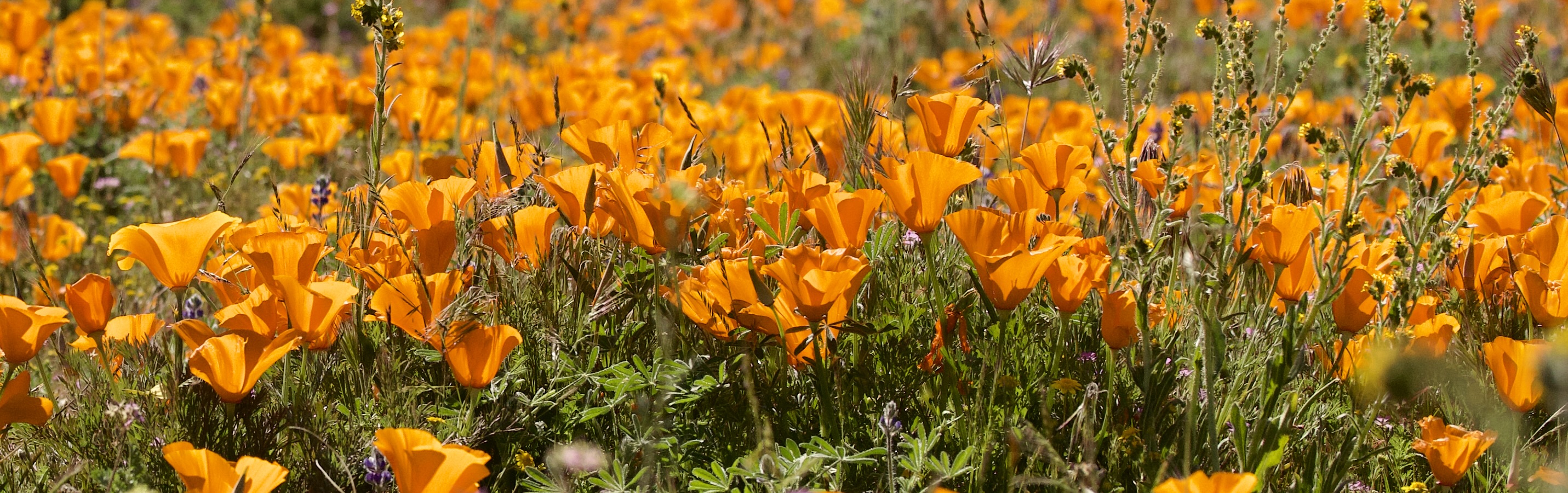
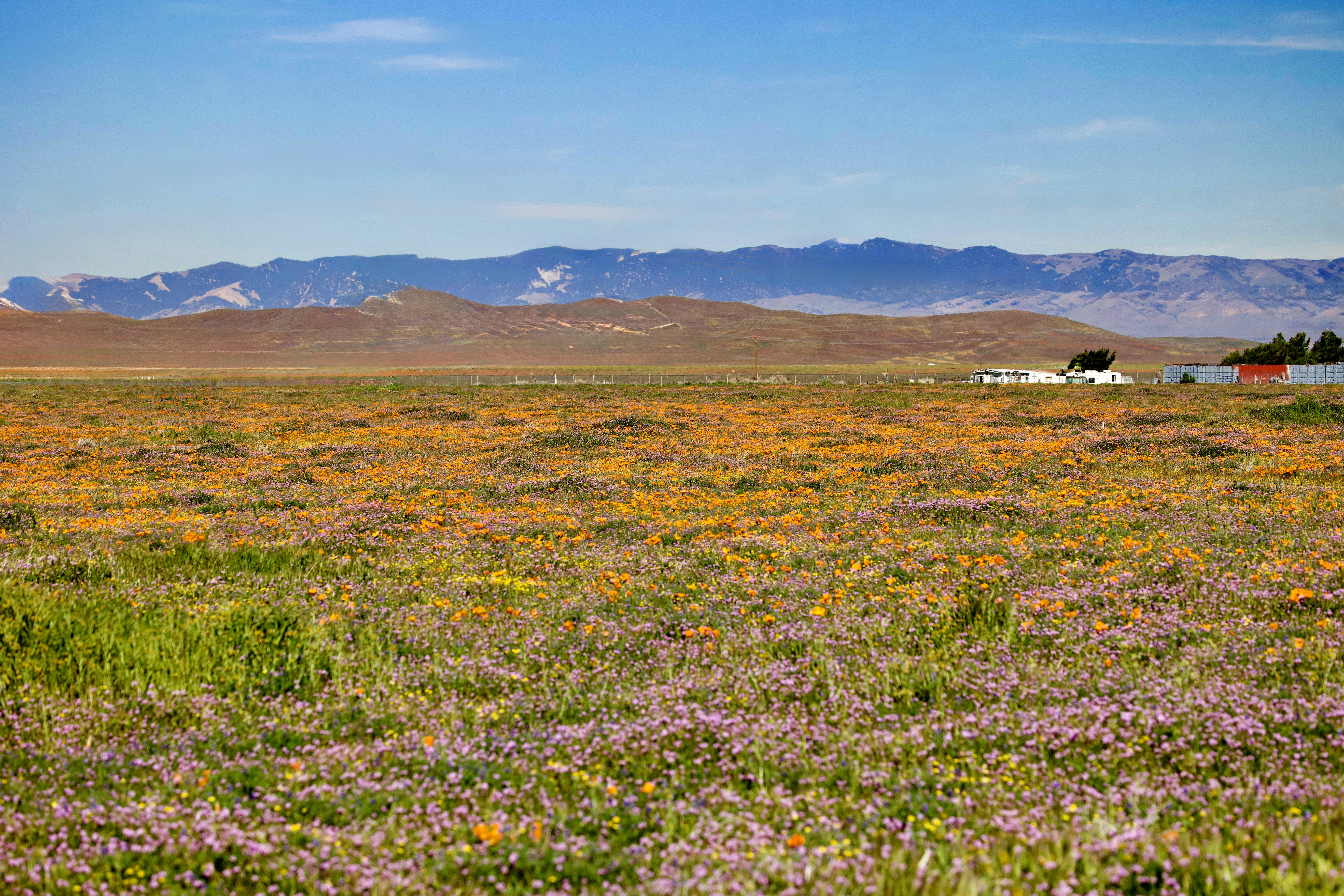
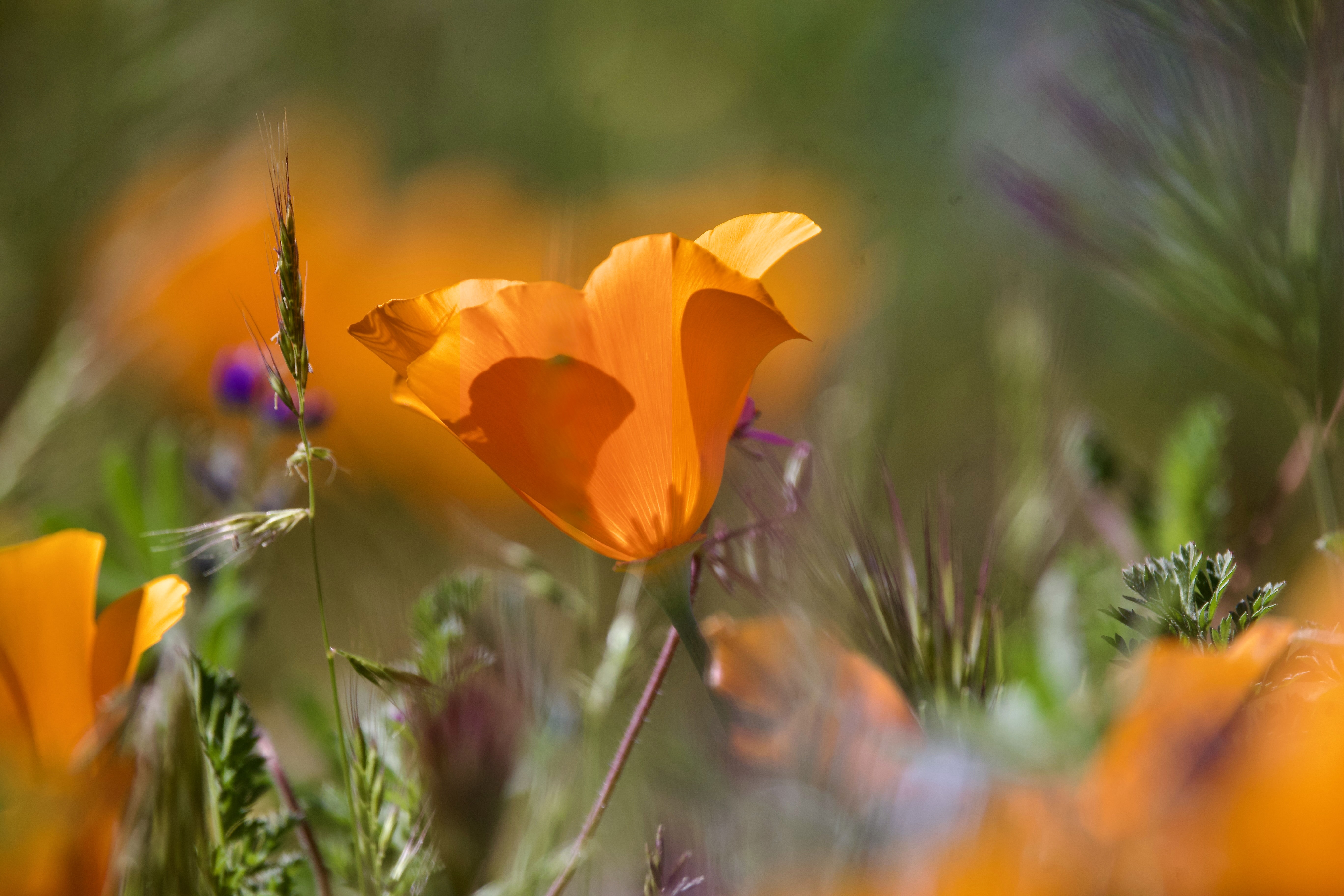
As I was still in a boot, (post heel surgery) walking and hiking was limited. We walked out on a paved trail. It allowed us to see over the Antelope Valley and enjoy all those beautiful orange flowers. But wait…there were many other flowers as well that helped those California Poppies pop even more.
What flowers grow among the California Poppies?
Goldfields: Yellow flowers that often carpet the fields alongside the poppies.
Owl Clover: Purplish-pink flowers.
Creme Cups: White, cup-shaped flowers.
Lupine: Ranging from dwarf to taller purple spikes.
Lacy Phacelia: Purple-blue flowers.
Coreopsis: Yellow sunflowers.
Red Stem Filaree: Small pink-purple flowers.
After spending the night in Lancaster, California we went back to the poppy fields the next morning. We never made it to the reserve. We discovered good dirt roads surrounded with poppy fields and many other kinds of flowers. We never resist a challenge. So, we took Phyllis’s Prius onto the dirt roads. We immersed ourselves in the flowers of the Antelope Valley.
I am a photographer so how could this post not include a video of my most current Best Day Ever. It is 7 minutes long. There is a slight pause between the first and second piece of music. Don’t leave too soon. And you can click on any photo in the blog and it will enlarge the photo. You can get more eye candy that way. Enjoy the Slideshow.
As most know I am a traveler and wanderer. I look for places outside. I look for wildlife to keep my camera busy. I have been stationary for almost six weeks. I have been getting itchy to move. I knew going into this heel surgery that the healing process is long. And I have been good giving myself the time to heal. I know that getting out was good for this wandering woman
I love nature. It always has the ability to surprise me. I knew I would see poppies. I did not realize how absolutely charmed and enthralled I would be among the fields of blossoms. It was so wonderful to spend the day looking at flowers and a few birds. It was breathtakingly beautiful. It made me so happy. It made me decide that this was one of my Latest Best Day Ever.
And a big shout out to Phyllis. It is always so wonderful to have a friend who is willing to go along on a last minute adventure.
Today I am thankful for the big wide open outdoors. There is always something new to find and explore and be in awe over.
In 1903 the California poppy, Eschscholzia californica, became the official state flower of California. The California poppy is commonly seen blooming in the spring and summer. It flowers along country roads and freeways throughout much of the state. This makes the plant a highly recognizable symbol of California. April 6 of each year is officially designated as California Poppy Day.
I have been asked many questions since I began my full time RV Lifestyle. Where is your favorite place? Are you going back to….? When will you choose where to live? What has been your best day ever.
There are many Best Days Ever. They can big days or little days, big events or little events. Best days ever make my heart sing no matter the size or event.
Last week I had my Latest Best Day Ever. A good friend of mine, Phyllis, and I decided to take a road trip. We drove four hours north to see the poppy fields in bloom at the Antelope Valley Poppy Preserve. We drove into the Poppy Preserve in the mid-afternoon on Wednesday.
As I was still in a boot, (post heel surgery) walking and hiking was limited. We walked out on a paved trail. It allowed us to see over the Antelope Valley and enjoy all those beautiful orange flowers. But wait…there were many other flowers as well that helped those California Poppies pop even more.
What flowers grow among the California Poppies?
Goldfields: Yellow flowers that often carpet the fields alongside the poppies.
Owl Clover: Purplish-pink flowers.
Creme Cups: White, cup-shaped flowers.
Lupine: Ranging from dwarf to taller purple spikes.
Lacy Phacelia: Purple-blue flowers.
Coreopsis: Yellow sunflowers.
Red Stem Filaree: Small pink-purple flowers.
After spending the night in Lancaster, California we went back to the poppy fields the next morning. We never made it to the reserve. We discovered good dirt roads surrounded with poppy fields and many other kinds of flowers. We never resist a challenge. So, we took Phyllis’s Prius onto the dirt roads. We immersed ourselves in the flowers of the Antelope Valley.
I am a photographer so how could this post not include a video of my most current Best Day Ever. It is 7 minutes long. There is a slight pause between the first and second piece of music. Don’t leave too soon. And you can click on any photo in the blog and it will enlarge the photo. You can get more eye candy that way. Enjoy the Slideshow.
As most know I am a traveler and wanderer. I look for places outside. I look for wildlife to keep my camera busy. I have been stationary for almost six weeks. I have been getting itchy to move. I knew going into this heel surgery that the healing process is long. And I have been good giving myself the time to heal. I know that getting out was good for this wandering woman
I love nature. It always has the ability to surprise me. I knew I would see poppies. I did not realize how absolutely charmed and enthralled I would be among the fields of blossoms. It was so wonderful to spend the day looking at flowers and a few birds. It was breathtakingly beautiful. It made me so happy. It made me decide that this was one of my Latest Best Day Ever.
And a big shout out to Phyllis. It is always so wonderful to have a friend who is willing to go along on a last minute adventure.
Today I am thankful for the big wide open outdoors. There is always something new to find and explore and be in awe over.
“I talk about him because I’m proud. I talk about him, because he deserves to be remembered. I talk about him, because even though he’s not physically with me, he’s never far from my mind. I talk about him because he’s part of me, a part that I could never ignore or disown. I talk about him because I love him still, and I always will. Forever. Nothing will ever change that.” I Talk About Him/Scribbles & Crumbs
On October 9, 2012, Jim, my husband entered the hospital for the last time. Neither of us knew that he would not leave and come home. Neither of us thought that the end of his life was around the corner. Neither of us knew.
Thirteen years ago on October seventeenth my husband of 21 years died. He entered the hospital the day before his birthday. Almost two weeks later, he died the day after my birthday. Yes October is a emotionally mixed month for me.
Oh, and wait a minute. October is Breast Cancer Awareness Month. I know that some people who have had breast cancer are dedicated to this month. I thank them for that. I, though from the beginning of having breast cancer in 2010 have wanted nothing to do with this month. I don’t want pink anything. I want to move forward without the celebration and thinking of myself as a survivor. I want to live.
Welcome to October Always an action packed emotional month.
It seems strange to think it has been thirteen years since Jim’s death. Sometimes it seems like it has been that long. Other days, it feels like it was yesterday. Sigh.
I spent most of my younger adult life thinking that I was going to be single my whole adult life. I made it to 38 and then Jim showed up and my life changed forever.
Each year I take time to remember Jim in writing, in thought and in love.
Jim & me dancing Contra Dance
Many relationships were made and dismantled on the dance floor of the New England Contra Dance community. If you have never tried this form of folk dance I suggest you try it. It is so much fun and it is certainly a way to meet people and make friends. And, oh the music! One night, this tall blue-eyed man showed up. That ended the idea of being single for the rest of my life.
Scottish Country Dance Ball
Jim followed me to other dance communities. He became a fine Scottish Country Dancer. We ballroom danced and chose to try several other forms of dance in communities around San Diego. It was fun. He did a mean waltz and polka. It was so much fun to have a dance partner.
The connection was strong and within a year we were a couple. I moved from San Diego in the fall of that year. I became a traveling nurse with Albuquerque as my destination. He didn’t want a long distance relationship. I said “How do you know if you don’t try it?”
Four months passed. Jim and I made several trips between Albuquerque, NM and San Diego, CA. I returned to the west coast and Jim. We moved in together and became a life couple. Was he my soul mate? I don’t know. I do know that even if it wasn’t perfect it was pretty darn close. From the moment we started to date we were close.
Everything was shared. Each month I would hike into the mountains to contemplate whether this was still a relationship I wanted. He would roll his eyes and waved me off. I would come back for another month. When I asked him if he had any doubts. He looked me in the eyes and said no. Eventually the monthly journeys move to every six months and then every year. I continued to hike and contemplate this wonderful relationship once a year until his death.
I have always been an explorer and adventure traveler. He joined me.
We took the train to Oregon. We climbed old growth Douglas Firs. and camped in the top of the trees. Did you know that there are no mosquitoes 25 feet above the ground? Since we were camped over 100 feet off the ground we were never bothered by those pesky little creatures.
Tree Climbing & Tree Sleeping
One year we kayaked the Nā Pali Coast off the coast of Kauai. The only way to see this coast is by helicopter or boat. On one of the short kayaks, we sailed through the air on the backside of a wave. Other travelers kept saying, “this doesn’t look good.” It wasn’t but oh the fun. We survived. When we finally kayaked the 15 miles down the Nā Pali coast, we went into caves. We greeted sea turtles swimming by. We got to see firsthand this amazing and remote coast.
Another Hawaii trip found us inner tubing through the sugar cane fields and kayaking the rivers on Kauai. This and the Big Island were our favorites places to visit in the 50th state.
On Tour of the Galapagos Islands
Other adventures included Ecuador and the Galapagos Islands. We Winter Camped and snowshoe hiked in Yellowstone National Park. We camped and explored Canyon de Chelly in Arizona by horseback. Jim had never been on a horse in his life. When a friend invited us to join her for a long weekend in Alaska. We enjoyed a long weekend of cross country skiing, yoga, and contra dancing. Always dancing. We explored our country, the outback and the cities.
Due to Jim’s love of astronomy we finally saw the total solar eclipse over Angkor Wat in Cambodia. During the summer months, the California desert becomes too hot. He would load all his astronomy equipment in the car and we headed to the desert. We camped in the remote areas of Anza Borrego State Park. There, we would stare at the heavens and talk into the early hours of the morning. The key to summer visits is to arrive after 5 pm. Be ready to leave by nine in the morning. Even in the summer the evenings are cool and pleasant. And…there is no one else out there.
Then there was the Grand Canyon, one of the seven natural wonders of the world. Jim and I hiked it a couple of times. The real life changer happened when we decided to take a river raft adventure. It lasted 15 days with friends from Lee’s Ferry to Diamond Creek.
Looking out at the Mighty Colorado
At first Jim wasn’t sure he wanted to go. It was too long. What would he do if he got bored? I made one phone call to a long time friend, Sharon, who had rafted the canyon several times. After his conversation with her, he hung up and we made reservations. After that trip we always talked about “Before Grand Canyon” and “After Grand Canyon”.
This is a description of some of our travels. There were so many more adventures than listed here. We were always looking for the next new adventure. It was such a great experience to have someone to share the unique and normal with.
Now I carry on alone but not really. I carry remembrance of him and our life with me. I move forward toward the next adventure. And I carry the joy of those 21 years with me as I grow and change and remember. Some people have said that I should let him go and move on. I am not sure what letting him go means. How can I do that? Those 21 years changed my life. They made me grow into the person I am today. I carry my growth with me always.
I continue to adventure by myself. My friend in our soft adventures is gone. I wonder sometimes how different my life would have been if he was still here today. Yes, I have no doubt I would still be with him. I would still be taking the hike into the mountains every year. I would watch as he waved me off. And then another year would unfold.
Today I am thankful for Jim, for our positive and wonderful relationship. I am thankful to move forward and be so much more than before I met him. Today I am thankful for Jim and all those years of adventure and wonder.
Just south of Vancouver BC is a point of land known as Point Roberts. Point Roberts is surrounded on three sides by water. It is bordered by Canada to the north. It is part of Washington state and the United States. The only way to get there is by car crossing the International Border or by private plane or boat.
On a sunny early summer morning I decided to visit Point Roberts. I drove from Richmond (south of Vancouver). I crossed the International Border and spent a late morning and afternoon touring this unique area of the United States.
Point Roberts was created in the mid-19th century. At that time, the United Kingdom and the United States settled the Pacific Northwest American-Canadian border dispute. They resolved the issue with the Oregon Treaty. The two parties agreed that the 49th parallel would define The boundary between their respective territories. The small area that incorporates Point Roberts is south of the 49th parallel.
During the 1858 Fraser gold rush, prospectors from Victoria, BC attempted to avoid tax collection. They briefly settled Point Roberts. Their settlement was called Robert’s Town. It consisted of six wooden buildings, including a store and saloon. It lasted less than a year.
In 1949, there was talk about Point Roberts seceding from the U.S. and joining Canada. In 1973, a drought that caused the wells to run dry created tensions between Point Roberts’s U.S. and Canadian residents. The Americans threatened to cut off the Canadian residents’ water supply. They also hung up signs saying “Canadians Go Home.” This was unless the Canadian municipality of Delta agreed to supply water. An agreement was signed on August 28, 1987. It requires the Point Roberts Water District to buy raw water each year.
During the COVID-19 pandemic, Point Roberts was acclaimed as the “safest place” for avoiding coronavirus. This was due to its isolation from the mainland United States and Canada. The very low case numbers also contributed to this reputation. Limited access to the rest of the United States and Canada was a factor. Additionally, border closures into Canada kept the case numbers very low.
As the pandemic worsened in both countries. In 2020, a study found that Point Roberts had lost 80 percent of its business. It also lost hundreds of seasonal residents. This was a result of the pandemic and border shutdown. The area was described as a “ghost town” by the local chamber of commerce director. It had no confirmed cases of COVID-19 as of September 2020.
The Port of Bellingham set up a temporary ferry in August 2020. It connected Point Roberts to the mainland. The Canadian government waived its mandatory COVID testing requirements for Point Roberts residents in 2021. The decision followed negotiations with Washington state. The border was fully reopened for non-essential travel in August 2021 and the ferry service ceased the same month.
The City of Delta installed a chain-link fence at the end of English Bluff Road in 2025. This was done to deter accidental crossings. An elderly man accidentally walked into Point Roberts. The fence was poorly received by local residents and at least one Delta council member demanded its removal.
The Marina
Approximately 1300 people live in the 5 square mile area of Point Roberts. The big attraction is the nature and the wildlife. Point Roberts has it all. The community has a golf course, a marina and two restaurants.There are four parks and coastal beaches to explore.
Lighthouse Marine Park is a 21-acre park on the Salish Sea and my first stop. Park amenities include a boardwalk, picnic areas,playground, trails, boat launch, and 30 campsites for weekend of camping. I chose to walk the beach trail to gaze out on the water. I hoped for whales but a seal was all I saw.
Mt Baker from Lighthouse Park
On a beautiful day I saw Mt Baker on the mainland, in Washington State. The beaches are like the beaches in Washington, Plenty of drift wood was scattered along the beach. The beaches are rocky and wild.
Monumet Park
This park is known for “Border Marker Number One”. It is the western most border marker between the U.S. and Canada. The park is a canopied forest of cedar and fir trees.
Lily Point Marine Reserve Park
Lily Point Marine Reserve spans 275 acres of forested upland and beaches. It is known for its towering sandstone bluffs. When beach-side, pilings can be seen running out into Boundary Bay. These pilings are remains from the Alaska Packers Association cannery. This cannery once operated here in the late 1800s.
Maple Beach
This beach is a popular spot for beach combing and swimming. It sits on the northeastern corner of Point Roberts. It is known for its sandy beaches and tidelands. At low-tide the tidelands stretch for a mile or more.
After a morning and early afternoon exploring I stopped for lunch at Kiniski’s Reef Tavern. The food was good and the view from outdoor seating was exceptional as I looked out over the Salish Sea.
Somewhere along my travels I read about Ollie-Otter’s Baker Box. I decided I needed to go find this interesting local landmark. There is a cottage bakery there Ollie-Otter’s Bakery is in a cottage behind the bakers box on the curb side. There were wonderful goodies waiting to be bought.
The Hungry Hound Barkary had a small box next to the street side bake box. This business is owned by Ollie Friedman. Ollie may have some growing to do but he has big dreams.
This is what is written on the sign in the photo.
“Hi I am Ollie. I own the Hungry Hound Barkary. Yep I’m 11 but I have BIG dreams. Someday I want to be an astronaut and work for NASA. To make that happen I need coding classes. So to raise money I’m taking over the dog treat business. Thanks for stopping and supporting my dream. I hope your pup enjoys the retreats.”
If you would like to support Ollie’s Dreams here is the link to his Go Fund Me Page. Ollie’s Path to NASA. I believe, much like my husband did, that it is important to support these young people no matter their dreams.
After a lovely morning and afternoon, I approached the International Border. I crossed back into Canada for a few more nights. Before I made my way back to the United States.
I enjoy exploring the unknown. I definitely would return to Point Roberts again. I could easily see camping there and taking a leisurely tour of the area.
I am grateful for my friends. They guide me to unusual places. This year I can add Point Roberts to places that are unique.
I have earlier written about magic moments in time, small and large. Some moments are so small and wee, they get overlooked. Then, there are other moments that are moments to pay attention to, to sit up, to notice and share.
Years ago, I went on one of my first trips abroad. I traveled with a friend, Kat for three months to southeast Asia. There were moments on that trip that reminded me of National Geographic , The Smithsonian and other magazines. I started to call them my National Geographic moments.
We traveled off the west coast of Thailand by boat to see the largest reclining Buddha in the country. It was in a cave out in the water. As we walked into the cave I noticed a large white sheet. It extended from high into the cave to the floor. Near it was a rope ladder that disappeared into the upper reaches of the cave. We saw people high in the cave. I said to Kat, jokingly, National Geographic is up there filming.
When I was back home I saw a copy of the latest addition of National Geographic. There was an article about the Thai men climbing high into the cave to collect nests for Birds Nest Soup. It was a National Geographic Moment. And I was there.
There were so many other moments like the above one on that three month journey.
Over my lifetime I have experienced many more moments that bring back instant memories.
Helliwell Provincial Park
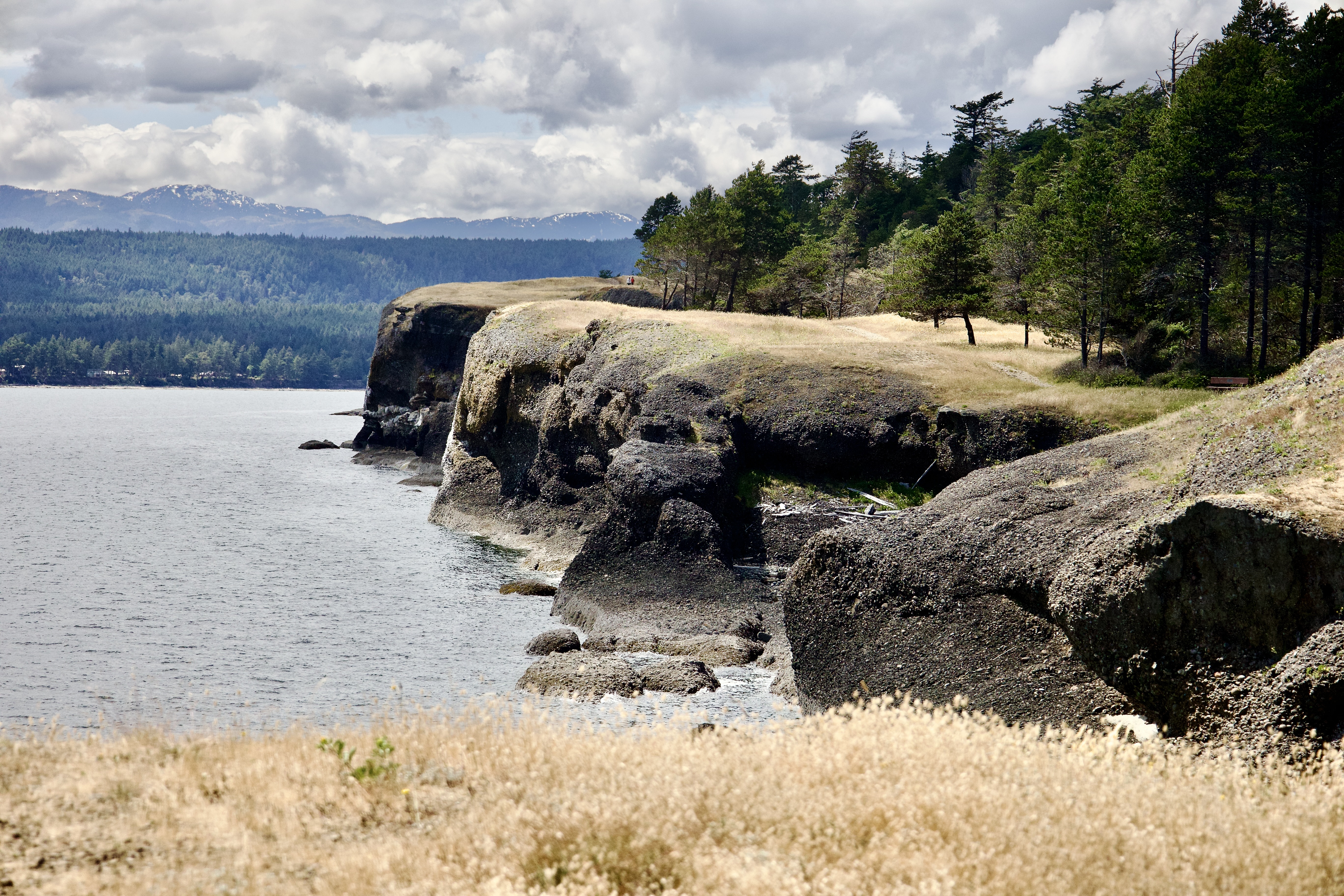
Two days ago I was visiting Hornby Island in Vancouver BC. I took a hike inHelliwell Provincial Park. This was a wonderful hike, through forest to the ocean and a hike along the cliffs.
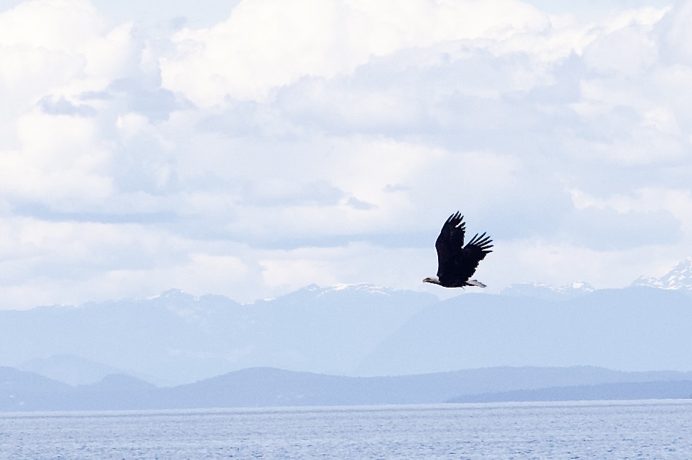
At one point I decided to stop and enjoy the view out across the water. Far out in the water, I noticed something. I thought it was a seal making its way to a spit of land. Did I have my binoculars with me? No. Did I have my long lens with me? No. The small spot disappeared and then became visible again.
A Borrowed Photo from the Internet. This is what I saw from a distance. Thank you Julia Tanncer (photographer)
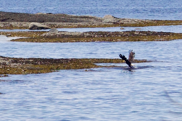
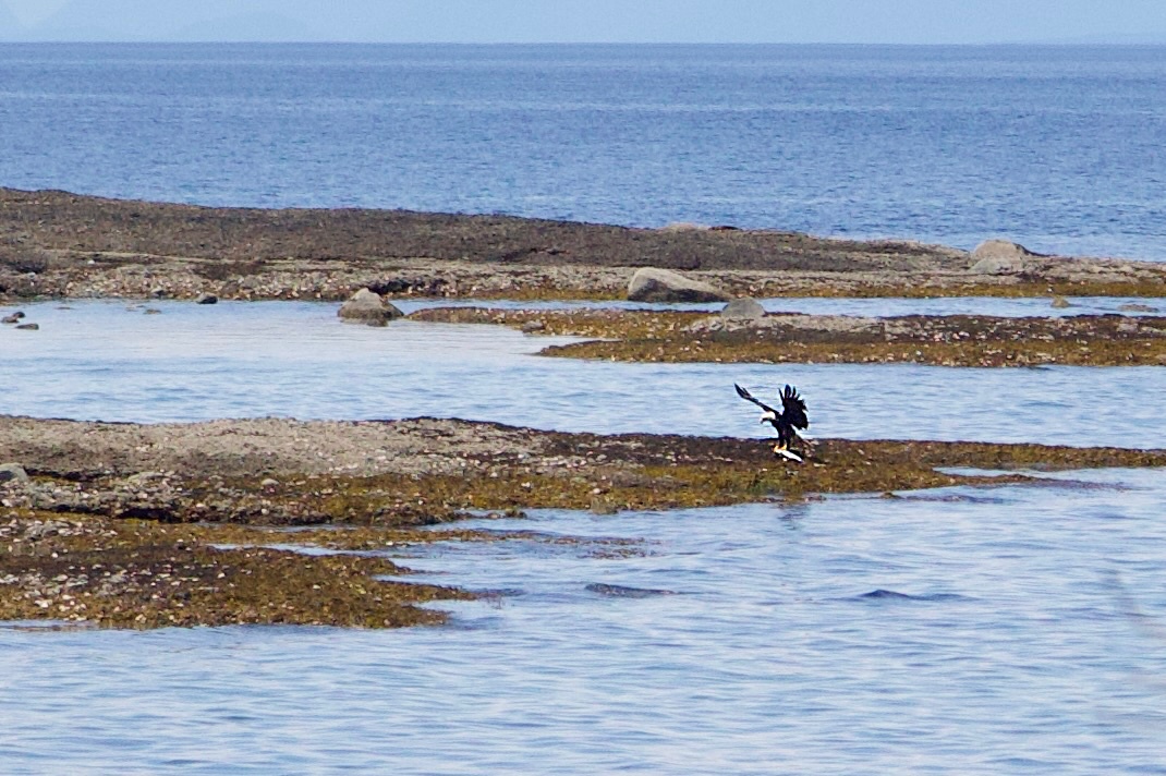
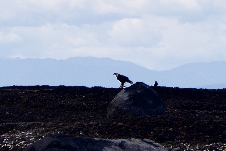
As it approached the spit of land it became clear to me that it was no seal or sea lion. An eagle appeared out of the water dragging what I can only guess was a fish in its talons. It dragged the fish up on land and slowly dragged its catch higher onto the spit. I imagine it had to dry off before it would even try to fly. Somewhere nearby was another eagle. They were calling to each other.
Reaching Dry LandA Pic of the FishFinally Airborn
Even without binoculars I felt for that moment in time, magic had come alive. It definitely was a National Geographic Moment. I never expected to see an event like this, even from a distance. It was an honor to be there to watch nature up close (kind of) and personal.
Moments like this make me wish that someone had been with me. We would have discussed what we were seeing. We would have been amazed together. It would have been fun to have shared this with another person. And maybe between the two of us we would have had a long lens or binoculars. Sigh.
Alone or with someone else these moments are so magical. It takes me out of thinking and acting and puts me in the here and now. For a moment everything else stops. It allows me to absorb fully what I am seeing. It can easily take my breath away. And just for a moment I am there.
Have you ever had one of these moments? Please feel free to share. I would enjoy hearing the magic of small or big moments in time.
Today I am thankful for the majesty of nature. I am grateful for stopping to se amazing things happen before my eyes. Today I am thankful for magic in my life.
There are moments in my life when I take great pride in my accomplishments and moments when I find joy in this continuing journey. I like feeling proud and accomplished for a job well done. It is good to stretch my knowledge and experience and know I can do more and be more. Feeling accomplished leads to feeling joyful. I attempt to look for those moments, large or small, that offer me the feeling of joy.
I have had a slow leak in the rear tire of my road bike. To deal with it, I pumped it up at the beginning of a ride and hoped it would still be OK after fifteen miles. I have been doing this for a while, and it has worked. Two days ago, I was out riding the Bay, and the tire was too soft after ten miles. Finally, I had to address this situation.
My Bike Feeling Picturesque
Before Jim died, I would have gone to him, and he would fix anything with my bike or car. If I had a flat while cycling, all it took was one phone call, and Jim would arrive to rescue me. Now, I have to think about calling Lyft or fixing that tire on the fly. That sounds easy, but changing a tire, especially a rear one, requires time, patience, and muscle.
Yesterday, I decided to change the tube on that tire. I did not have all the necessary tools; where did that bike tool set go? With the help of one tire tool and a few kitchen tools (the mother of invention), I successfully changed the inner tube and was up for a 15-mile ride around the bay.
Pride, oh yes, I feel proud. Whenever I tackle something independently and succeed, I feel proud of myself. I also know that the correct tools will be present next time, making it easier for me to accomplish this task. This is good pride. This is joy.
Joy has been on my mind often lately. I have been considering what gives me joy every day. What are the little things that make me smile each day? Yesterday, successfully changing that tire was a moment of joy at a well-done task. Pride and Joy.
Yesterday, I was at Starbucks, and one of the baristas came by to give me a free sample of Christmas coffee and bread. It made me smile and feel special. Joy at work.
What has brought me joy as I traveled over the past spring and summer? Friends, oh yes, Friends. My life would be so lonely without the love and support of new and long-time friends. I met people on Vancouver Island this summer who have invited me back to visit and live with them. How cool is that? I have people who have embraced me and made me feel treasured and valued. They have invited me into their homes and driveways, making me feel unique and loved. That is definitely Joy.
Unlimited joy, large and small, has come in the form of a little brown bird, Birdie Boy. When I think of my time in the Northwest, I immediately think of Whidbey Island, Jim and Sandy, Robyn and Tom. They think I am wonderful, and the feeling is mutual.
Mostly, I think of Birdie Boy.
How can a little brown song sparrow infuse me with such joy? How can Birdie Boy still remember me two years later? How can he express such joy at seeing me again? He leads his own life, yet I show up, and his and my world stop. We met on the deck in the spring of this year. He sat atop my computer screen and chitted at me non-stop. We had a lot to catch up on. My heart expands with great and small joy when I think of all my encounters with him. Who knew this little brown bird would be so crucial in my healing from the loss of Jim twelve years ago
I love my camera. I love being out in the wild, taking photos of birds, animals, and just about anything. Nature always cheers me up. My photos can bring me such joy. I love looking through my pictures and picking out my favorite of the day.
Socks…New socks! A few days ago I bought 3 pair of new socks. I love putting them on. I love their colors. Their softness is delightful. New soft cushy socks equals joy.
I must note those moments of accomplishment and joy in my life. When things look a little dark or sad, I find that if I can recall one moment of pleasure in the day I am in or from the past, my mood lightens, and things don’t look as bad. Finding joy, no matter how small, reminds me of life’s magic. It helps me take another step forward and often reminds me that I am not alone.
What are your small or significant moments of joy?
What have you accomplished that has made you feel joyful and proud? Please share in the comments. I would enjoy seeing them in print.
Today, I am Thankful. I am grateful for my friends. I am thankful for the little and big moments of success in a job well done. I am thankful for any wee moments of joy in my life.