Travel Log: Exploring Dubrovnik: The Pearl of the Adriatic

I thought I was done with the Travel Log, yet there is one more post I want to share.

Why? Dubrovnik, Croatia deserves a post all of its own. What a delightful place to end this trip.

The”Pearl of the Adriatic” situated on the Dalmatian coast, became an important Mediterranean sea power from the 13th century onwards. Although severely damaged by an earthquake in 1667, Dubrovnik managed to preserve the beautiful Gothic, Renaissance and Baroque churches, monasteries, palaces and fountains. Damaged again in the 1990s by armed conflict, it is now the focus of a major restoration program coordinated by UNESCO.

Zee and I had two full days in Dubrovnik, and it didn’t feel like enough time. This is a town of approximately 40,000 people. There was a time when the old town, which is surrounded by two walls, held the lives of close to five thousand people. Today, approximately 800 people live inside the walls. 

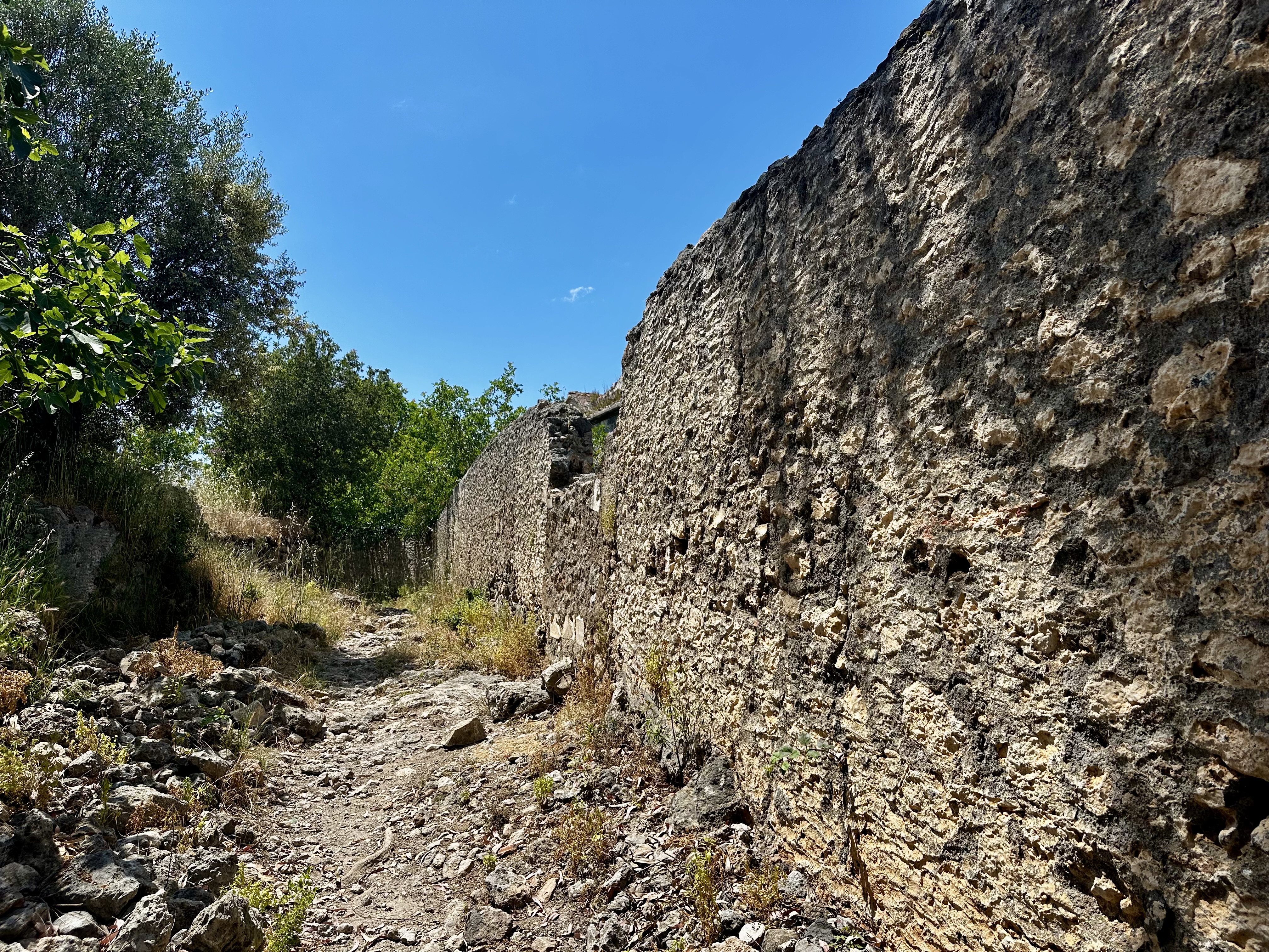
The city walls, mostly a double line, have long been a source of pride for Dubrovnik. The walls were erected in the 16th century and run for about 6,365 feet (1.3 miles, encircling most of the old city, and reach a maximum height of about 80 feet. Along its course within its walls lie several towers and fortresses, as well as numerous historic monuments.

What is it like to live in a city this old? It’s not easy. Everything needs to be carried in by self-labor or by a little cart for a good amount of money. No cars, no scooters. I did see an occasional bicycle or push scooter, but most of it is walking.

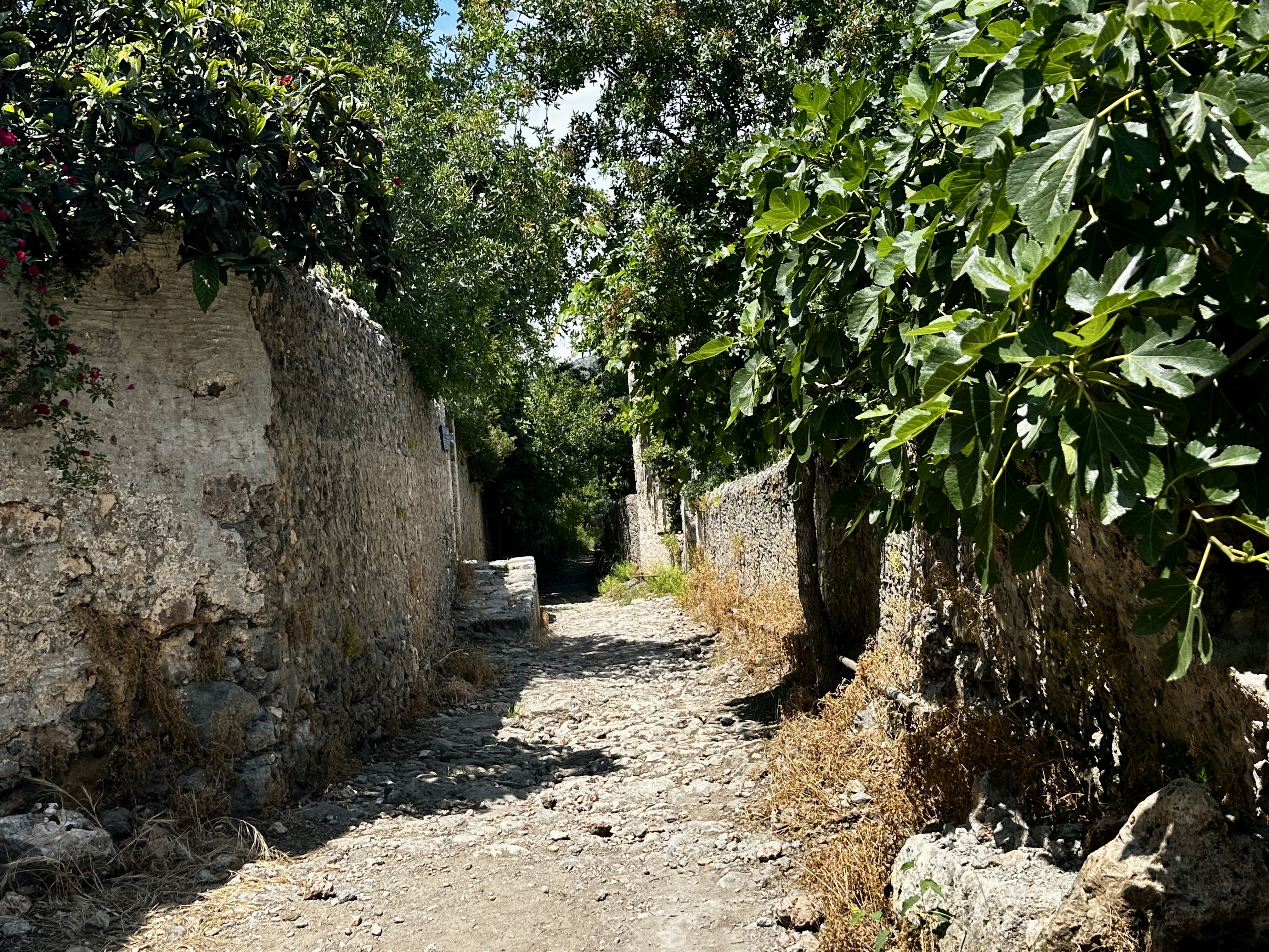
No motor vehicles are allowed inside the walls, and, except for the Stradun, the old city is a maze of picturesque narrow streets, many of them steep and twisting.

Outside the Wall

For families that have lived within the walls, living there is easy. For others who move in from outside, life within the walls is hard and not well loved. 

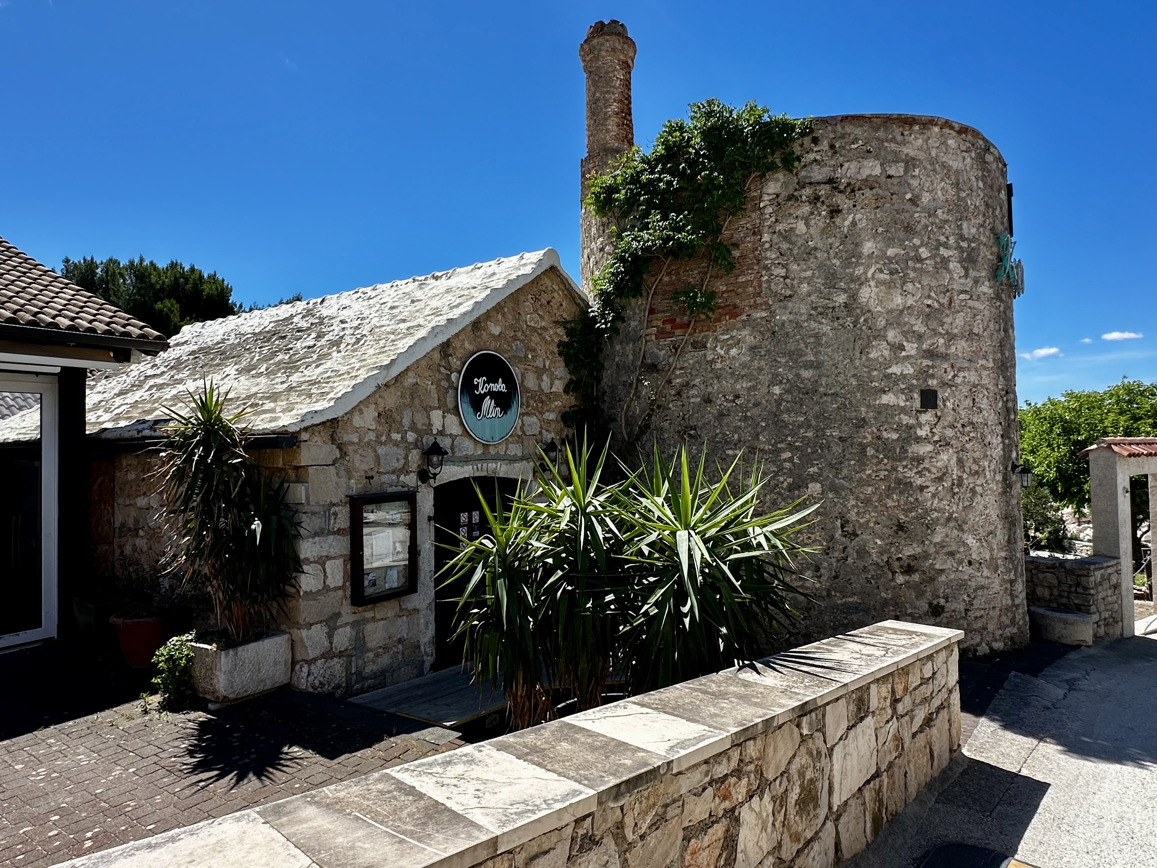
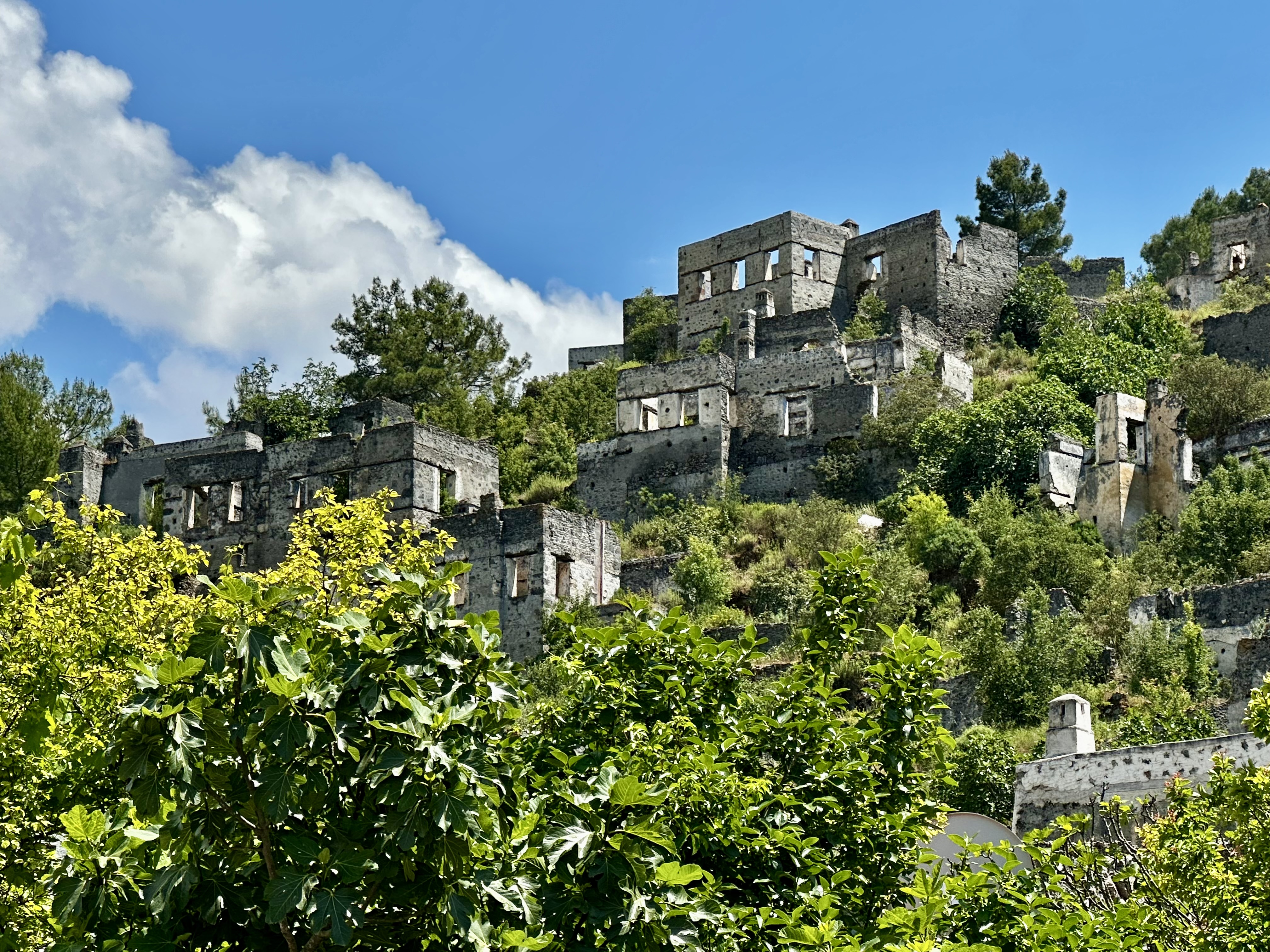
Beyond the walls are many gardens that surround many villas.

Interesting Sites Within & Outside the Walls

The Orphanage

One side street has a difficult history. In earlier centuries, some infants born to household maids were abandoned or harmed. Local nuns later established an orphanage to provide a safer alternative. Mothers could leave infants anonymously through a rotating basket system, allowing the children to be taken in by the orphanage.

The children would stay until they were 6 years old, and then farmers would claim them for labor on their farms. It was not always an easy life for the children.

Worlds Oldest Grafittii

The oldest graffiti in the Old Town of Dubrovnik is unique and historically significant. It was carved in 1597 on the east wall of the church of St. Rocco. The content and message of the graffiti, written in Latin, is cautionary and philosophical.

The graffiti reads: “PAX. VOBIS. MEMENTO MORI QVI. LVDETIS PIL”, which translates to “Peace be with you, remember you who play the ball will die”. This text is aimed at young football players, reminding them of mortality and the transience of life. It’s a kind of reminder that while play and entertainment are important, life is finite and every moment should be cherished.

Proposing Marriage

Proposing with an earring is a beautiful, deeply rooted Croatian custom. Traditionally, men in the Dalmatia region gifted a small pair of intricate filigree earrings to their fiancée for the engagement. Later, during the church wedding ceremony, they would gift a larger pair to signify she is a married woman

The Church of the Holy Annunciation

This church is a stunning Serbian Orthodox church located in Dubrovnik. Built in 1877, this Neo-Byzantine style church is home to a remarkable collection of icons dating back to the 15th century. The church also boasts a library with over 12,000 books, including a rare New Testament printed in Kiev in 1703.

I learned that this church allows its priests to marry. They have no confession, and although the services are two hours long, it is standing room only in this beautiful church. There were some high-backed wooden chairs along the side for the elderly and infirmed.

Quarantime

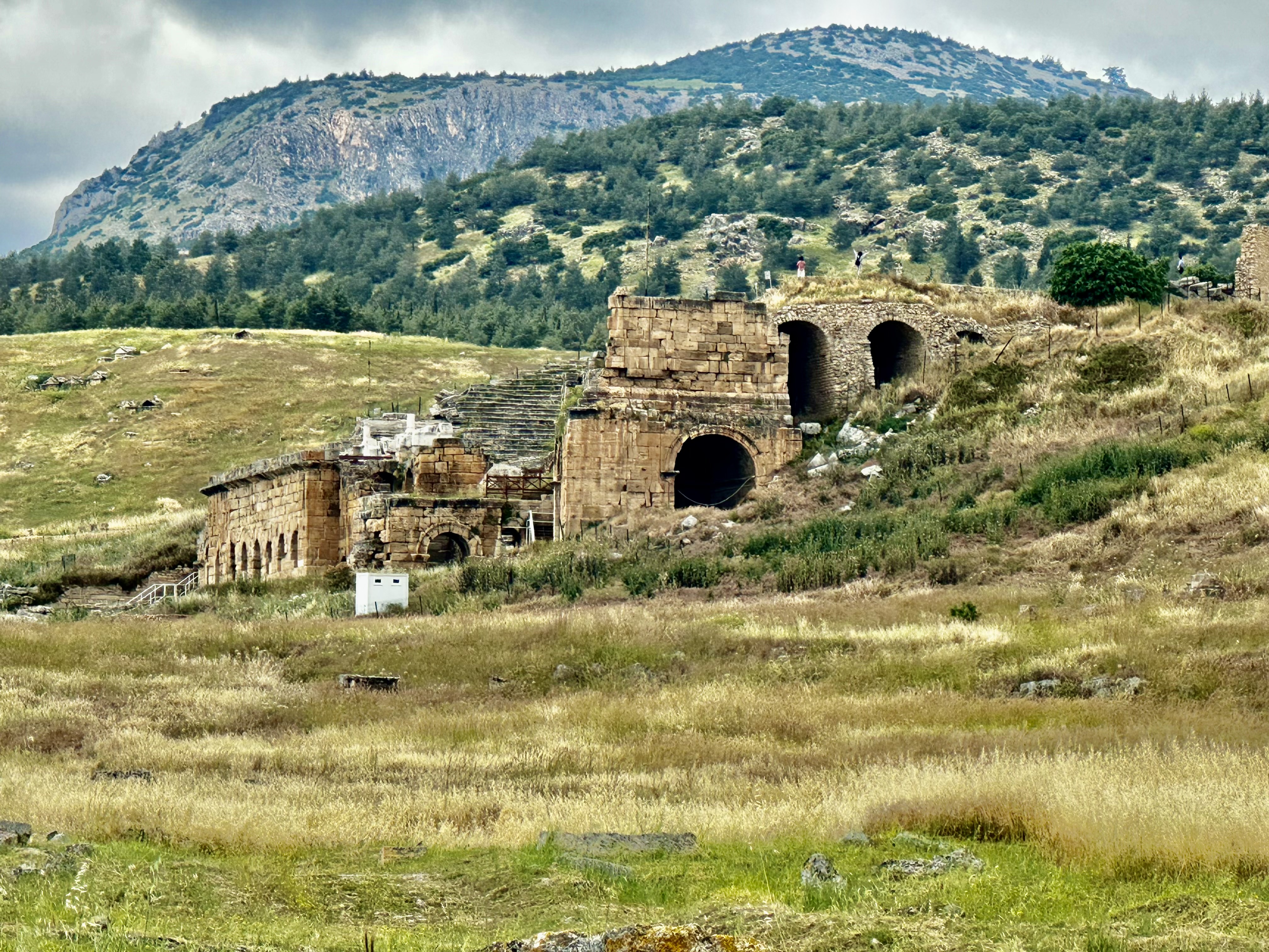
Between the 14th and 16th centuries, Dubrovnik was a key hub in the trade between the Ottoman Empire and the West. Its Lazaret, or quarantine station, was built in 1627 to isolate the ill and prevent plagues from entering the city through people on the ships entering its port.

The walls surrounding the complex were added in the 18th century following the outbreak of a deadly epidemic. Considered the most humane and efficient facility of its kind at the time of its construction, the lazaret continued to fulfill its original function as a quarantine unit until the beginning of the 19th century. After its closure, it slowly deteriorated due to lack of maintenance and damage from by salt air, fire, earthquakes, and civil unrest. Modest repairs to the complex occurred in 1969-70.

The Dubrovnik lazareti is one of the only remaining and best preserved examples of its kind in Europe, and the only example of a maritime lazaret in the Mediterranean. Its survival with a large portion of its original materials, details, shape, and structure is unusual. Most comparable structures, including the oldest ones in Milan and Venice, and smaller quarantines on the Dubrovnik islands, were pulled down after the threat of plague had passed.
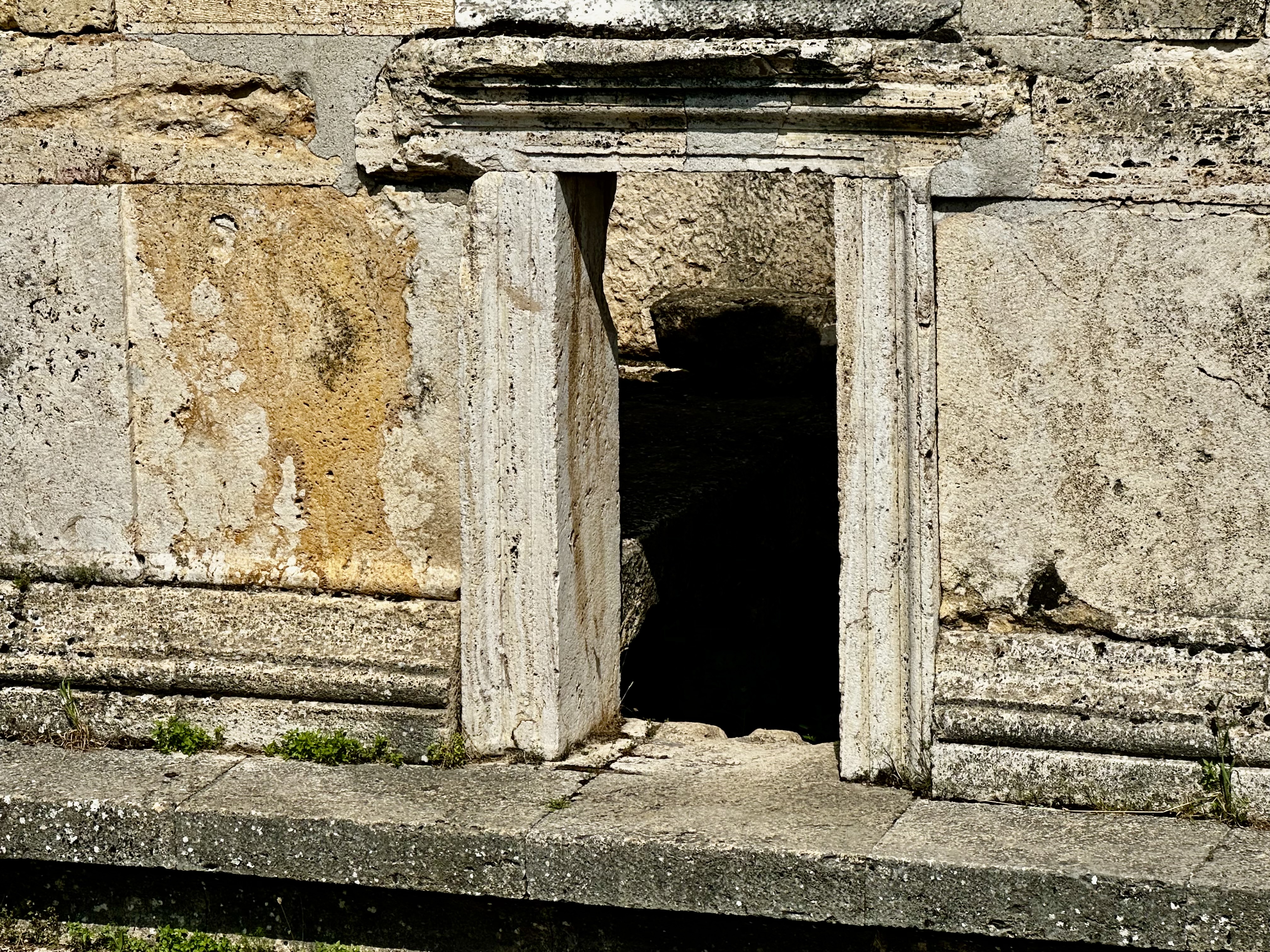
What is This?

I saw these in a few of the walls. The original part was the thin straight opening. Arrows were shot through these openings in defense of the city.

Later, the round area was added when cannons became part of the defense of Dubrovnik.

The Game of Thrones

Dubrovnik was a major set for the HBO series “Game of Thrones”. It was filmed in the Old City and in areas outside of the town. I have never watched this, but Zee is a big fan. Here are some of the areas you fans might recognize.
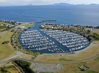
E1 series Racing

And finally into the current day. The E1 Series was in Dubrovnik while we were there. The E1 Series is the world’s first all-electric powerboat championship. Often called the “Formula 1 of the sea,” it combines sustainable marine technology with high-speed racing in iconic global cities. 

It was fun to sit with other people to watch the races. I enjoy coming across unexpected events such as this.

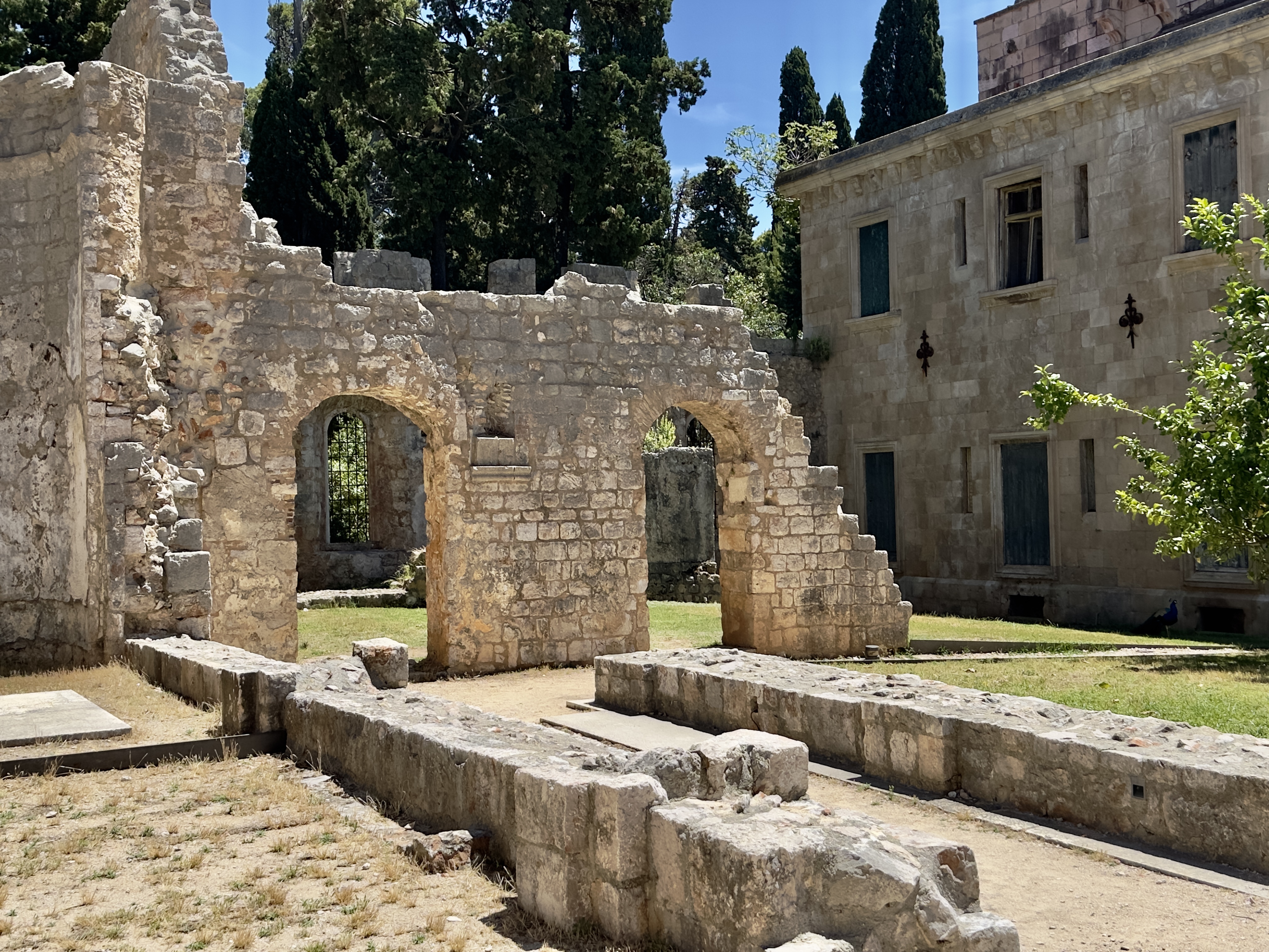
Before we went to the airport, Zee and I took one more ferry to Lorkum Island. It was a short ride. The island is part of the history of Dubrovnik. Lokrum Island is a small, lush nature reserve located just off the coast of Dubrovnik. It is famous for its Benedictine monastery ruins, wild peacocks, and the “Dead Sea” (a small, salty lake for swimming). The island is also a popular Game of Thrones filming location.

And just like that, it was time to go to the airport. It was time to say goodbye to Croatia. Both of these countries, Turkyie and Croatia, were hard to leave behind. Maybe I will be back again someday.

Currently, though I returned to the United States twenty-four hours ago, late in the evening. And a wonderful holiday is over. As long as I can, there will be other adventures to discover.

And one more time.

A Travel Log of Korčula: From Old Town to National Parks

One more Croatian Island to go. After leaving Hvar, we moved on to Korčula, another unique Croatian town and Island. I felt like I had walked into the movie set for The Lord of the Rings. True towers, a drawbridge, battles from the ramparts, pirates, and more.

Compared to Hvar and several other places I visited, Korcula was quiet. There were tourists there, but not in the numbers I had seen in many of the other parts of Croatia.

Korčula has been inhabited since prehistoric times, as evidenced by Stone Age finds from Vela Spila near Vela Luka, now part of the Vela Luka Culture Center’s collection. In the 4th century BC, the Greeks founded a colony on Korčula and called it Korkyra Melaina or Black Korčula. Under their rule, the island was called Korkyra Nigra. The attribute “Melaina” or “Nigra” this beautiful island owes precisely to the lush Mediterranean vegetation, primarily forests of holm oak and pine.

The island of Korčula is almost completely connected to Pelješac by the Pelješac canal. The town of Korčula is among the most beautiful and best preserved medieval towns on the Croatian coast and in all of the Mediterranean, and is justly referred to as “Little Dubrovnik.” It still has the appearance it had at the turn of the 16th century – the same stone towers, walls, and the same fishbone structure of the streets.

Korčula’s town planners took into consideration both functionality and perfect harmony with nature – the streets are lined so that the refreshing wind from the west can pass, while the cold winter winds from the northeast (called bura) are blocked.

We started our exploration of Korcula with a walking tour of the “Old Town”. Old town, of course, means within the fortress walls. Our guide was very informative. The creation of this town was planned well.

The steps are a later creation. There used to be a drawbridge where the steps are today. If the enemy came, they drew up the bridge. If you enlarge the photo by clicking on it, you can see the holes in the tower where the ropes were for the drawbridge.

The streets of Korčula’s Old Town are designed in a brilliant geometric herringbone pattern. Built in the Middle Ages by the Venetians, this layout acts like natural air conditioning, controlling the wind and the sun to keep the town comfortable.

How the Herringbone Design Works

  • Central Spine: A single main street divides the old town, running straight along the top of the island’s ridge.
  • Western Streets: The streets on the town’s western side are laid out in straight lines. This lets the refreshing summer breeze, called the maestral, blow straight through the town and cool the houses. 
  • Eastern Streets: The streets on the eastern side are slightly curved. This curve blocks the fierce, cold winter winds, known as the bura, from rushing through the city and freezing the homes. 

Other unique features of this town are included below.

Hidden Plumbing: The houses are built in long, parallel blocks. The fronts of the houses face the streets, while the backyards and wastewater canals were cleverly hidden in the middle of the blocks.

Narrow and Shaded: The side alleys are incredibly narrow. This provides deep shade during the hot summer months, ensuring the sun never hits the ground directly. 

Stepped Alleys: Because the town sits on a small hill, almost all the side streets use steps to help you climb up and down easily. 

Arches Across the Alleys: You owned a small home. If you wanted to expand and acquired the home across the street, an arch was built to connect the kitchens.

The Kitchens & Bathrooms: To prevent fires, the kitchens were on the top floor. The bathrooms were on the first floor.

The Street of Thoughts: There is one notable street running along the southeastern wall, without any steps. Local history says it was called the “Street of Thoughts” because walkers did not have to stare at their feet to watch for stairs.

Korcula Old Town, Within the Walls

Unique in its design, the system still had some flaws. The town was once home to close to 1,000 residents. They lived there for protection and community. Today, approximately 300 live within the city walls. Why? Look how narrow the streets are. No cars can come into these streets. That means you have to carry everything in and out of the walled city. There are steps everywhere; only one street has no steps.

While we were exploring the old city, we climbed the bell tower at the Korcula Cathedral. The stairs were not for the weak of heart. The view from the top was breathtaking. I hoped the bells did not ring while I was up there.

Climbing the Cathedral Tower.

One evening we went to the west side of the walled city to have dinner and see the sunset. People seem to do that a lot here. It was not disappointing.

Sunset View

On the second full day, we took the ferry, a 35-minute ride, to the island of Mljet. One of Croatia’s National Parks is on the island. With a bit of trepidation, along with Mary, I rented an E-bike to bike the park. After a few practice runs up and down the main street, I was ready to go.

Mljet National Park is a large area that borders two saltwater lakes. The Lakes stretch for about 4 kilometers. Right in the middle of the Large Lake, there is a small island/islet, Melita (Sveta Marija), with a large building of the former Benedictine monastery, erected there in the 12th century. The monastery’s building is now a café/restaurant. The small island is connected by boats that sail there from both sides of the Lake.

Miljet National Park.

The Benedictine Monastery is now a restaurant. You flag them from the mainland, and they send a boat over to pick you up. It was early, so we pushed on.

There was a small steep bridge we needed to cross with our bikes. Up, Up. Down, Down. Have I told you how heavy E-bikes are? Our very own angels showed up. They easily lifted the bikes up and down while Zee and I followed behind.

The bridge is fairly new. At one point, Tito moved to the island with the Monastery. He tore down the original bridge to gain full access to the ocean and bring in supplies. After he left, the new bridge was built.

The National Park was cool, quiet, and unhurried. It took us about 3 hours to bike the park. I enjoyed stopping and looking at all the Butterflies on the thistle and lavender.

Upon our return to the ferry port, we found a cool place in the shade, met this lovely woman from Switzerland, and chatted until the ferry returned us to Korcula.

Today we say farewell to the islands and return to the mainland. Back to the big city, Dubrovnik. Well, not quite the big city, as Dubrovnik has approximately 40,000 residents. I am not quite done exploring yet. We have two full days to explore before returning to Istanbul and the flight stateside. Oh, what a trip it has been.

Travel-log – Hvar Island: From Ancient Times to Modern Luxury

Time on the islands of Croatia never feels long enough. With the warm sunny days and the beautiful blue Adriatic Sea, it feels like I could spend more time on each of the islands I have visited. But wait…there are more islands to visit. I guess I will have to return.

A true hedonism has been present on the island of Hvar, ever since the time of sumptuous Roman villas, springing from the walls of Renaissance summer houses, and, despite all the challenges of island life, it slips even today into the reveries of modern nomads who enjoy the splendor of Hvar, where, 157 years ago, organized European tourism began.

As one would expect on an island, the history of Hvar has been broadly shaped by outsiders, each invading force leaving its mark, resulting in a rich cultural, archaeological, and architectural legacy.

The earliest signs of civilization on Hvar date back to Neolithic times and the so-called Hvar Culture of 3500 – 2500 BC.

Given its prominent position on a busy sea route, it is perhaps surprising that the island was not settled earlier than 384 BC, when the Ancient Greeks founded the settlement of Pharos (modern-day Stari Grad). The Ionian Greeks, the Parans, were in search of a base for military and trade expansion, and the deep bay at Pharos offered the best protection.

The first recorded naval battle in the Adriatic took place just off Hvar, with the Greeks successfully taking on the native Illyrian tribe of the Liburni.

With the decline of the Syracuse Empire, Pharos enjoyed a brief period of local rule under Demetrius of Hvar, who kept the Romans at bay until they finally smashed the walls of Pharos in 229 BC. The Romans used the island as a strategic and logistical base, keeping their boats in the protected bays of the Scedro and the Pakleni Islands. Roman holiday houses sprang up in the bays close to fresh water, most notably in Hvar, Stari Grad and Jelsa. Archaeological finds confirm that the islanders were engaged in wine growing, fishing, and trade.

There is little recorded about Hvar after Roman rule, but the island, along with the surrounding islands, was under the Croatian state of the Neretljani in the early Middle Ages before being briefly occupied by Venice in 1147. This was only temporary, however, as Croatian-Hungarian King Bela III managed to bring Dalmatia under his rule.

The Venetians were back in 1278, having been invited back by the islanders looking for protection from the pirates of Omis. One of the early changes the Venetians introduced was moving the central administration from Stari Grad to Hvar, and the new center became a regional administrative center for Hvar, Vis, and Brač. A plan to build walls around the town and monastery was initiated in 1292.

Venice’s rule was far from secure, and the island’s noblemen rebelled in 1310. Hvar’s rulers changed several times (Croatian-Hungarian kingdom, Bosnian kingdom, and Dubrovnik) before, along with the rest of Dalmatia, a more protracted period of Venetian rule from 1420 to 1797.

Hvar became the main Venetian port in the eastern Adriatic, but was under constant threat of attack from the Turkish fleet, which controlled the mainland near Makarska. A devastating Turkish naval attack in 1571 under Algerian commander Uluz Ali in 1571 laid waste to Vrboska, Stari Grad and Hvar.

Hvar prospered under Venetian rule and was known for wine, lavender, olives, rosemary, fishing, and boatbuilding. More than three centuries of Venetian rule came to an end in 1797, when the Austrians briefly took over before being themselves usurped by the French. The Russians bombarded Hvar in 1807 in a period of general instability and warfare in Europe, until the Austrians retook control in 1813, a rule that lasted into the 20th Century.

Austrian rule was stable and brought prosperity, most notably in the development of health tourism on the island, with the founding of the Hvar Hygienic Society in 1868. The oldest meteorological station in Croatia was also established in 1858. Austrian rule also brought infrastructure improvements to the island, including the rebuilding of all the ports, the construction of new lighthouses, the reclamation of malaria-infested marshland, and the construction of a road connecting Jelsa to Pitve and Vrisnik in 1907.

The Italians were back in November 1919, occupying Hvar once more after fierce fighting, an occupation which lasted until the 1921 Treaty of Rapallo consigned the island to membership of the Kingdom of Serbs, Croats and Slovenes, later the first Yugoslavia and then the Socialist Federal Republic of Yugoslavia.

Hvar’s latest (and one would hope permanent) change of master occurred on January 15, 1992, when Croatia was recognized as an independent state.

The former Yugoslav army (JNA) attacked Croatia in July 1991, and Hvar was blockaded the following month. The main effects of the blockade were shortages of foodstuffs normally brought from the mainland, such as flour, and a lack of access to hospitals and other medical services.

A ceasefire was signed, and the navy left Sucuraj territorial waters on December 3, 1991.

St Stephens Square

The situation on the ground in the mainland was dire, with large tracts of Croatia occupied. A steady stream of refugees had to be housed, and a logical supplier of beds was Hvar, devoid of tourists due to the conflict. Refugees, particularly from the front-line town of Vukovar, began to arrive by boat.

The refugee situation deteriorated in 1992 as Croatia took in numerous refugees from the brutal war in Bosnia and Hercegovina. The effect of traumatized refugees replacing affluent tourists was twofold: a severe reduction in revenue and a severe increase in wear and tear in the hotels.

A UN fact-finding mission in August 1992 found that there were 624 displaced persons and 3,727 refugees on Hvar, of whom 1,323 were in private accommodation, the rest in hotels. Usually closed in winter, most of the hotels had no heating installations, which caused problems for the new temporary residents.

With the demographic balance upset in both directions – an increased population during the winter and a decrease in the summer due to a lack of tourists – the hotels were full year-round, which had a negative impact on the condition of the buildings.

The absence of many paying visitors had a devastating effect on the island’s economy, leading to the closure of many cafes and restaurants.

The cafes & restaurants closed due to a lack of electricity (from the occupation of the Peruca dam, the source of hydroelectric power) and difficulties obtaining necessary goods such as coffee, milk, etc., from the mainland. Many of Hvar’s male population were drafted into the defense forces on the front line near Zadar, where one man from Stari Grad was killed, and many more returned suffering from PTSD.

Thankfully, both Hvar and Croatia have recovered well from those dark days. A highly successful marketing campaign under the slogan, Croatia, the Mediterranean as It Once Was, proved very effective, and a new generation of tourists joined the returning older generation to discover the magic of the Adriatic. Hvar was named one of the 10 most beautiful islands in the world by Condé Nast readers back in 1997, and it has never looked back. Major investments in the town’s hotels and the upgrading of cultural treasures such as the Arsenal and the oldest public theatre in Europe has meant that Hvar is once more a major luxury tourism destination on the Croatian coast.

A trail from Hvar leads to Napoleon’s fortress, built in 1812 on top of a 230-meter-high hill above the town of Hvar. Today, Napoleon’s Fortress is home to the Hvar Observatory. The research office is dedicated to astrophysics and has the largest star telescope in Croatia with a one-meter mirror. The trail from Hvar leads along a narrow, steep path through a beautiful pine forest to Napoleon’s Fortress. The fort offers a beautiful view of the town of Hvar and many nearby islands, such as the Pakleni Islands, Vis, Brač, and Solta.

We did not have time to visit this fortress while we were there. The stairs looked daunting, and we had excursions while on the island. I would go back just to explore this Fortress.

The first evening included a sunset sail and swim. The water was not as warm as I expected. Our captain told us to give it a few more weeks, and it would be warming up for the influx of tourists in the busy season, July and August.

Our first full day, we took a high-speed boat tour to the outer islands, including the island and town of Vis.

In 397 BC, Dionysius the Elder, ruler of Syracuse, founded the colony of Issa, known today as Vis.

And like many other posts on my blog since my arrival to Turkyie the history of Vis is of the rise and fall of empires.

Much like the surrounding islands and area, Vis fell to French and then Austrian control. However, following the Battle of Lissa in 1811 (between the British, the French, and the Venetians), British bases were established on the island, including George’s Fortress. As part of the Austrian Empire, Vis became a naval base and was strategically important in a sea battle between the Austrians and Italians in 1866 (with Croatians making up a large number of the sailors on Austrian ships).

During World War II, Vis was the hiding place of partisan/resistance leader Josip Broz Tito, who became leader of Yugoslavia after WWII. During this war, Vis was also a major base for British and Allied troops – there is a British military cemetery on the island. Allied fighter planes were also based there.

A sign in front of a cave on Vis marking the fact that Tito – leader of the Yugoslav Partizan resistance movement during World War II – stayed and worked here in 1944

After 1945, Vis was closed to tourism by the Yugoslav army as it was used as a major naval base. The pictures below show bunkers on the island. They also had a hidden water bunker for any captured submarines.

It was reopened to foreigners only in 1989 and was part of Croatia, which gained independence in 1991. All the navy/military buildings on the island were abandoned at that time, although many of them can be visited today – including the cave in which Tito ‘hid’ in during World War II.

It was a full day of traveling and swimming. I took time in the evening to do what so many others do in Hvar. I walked the waterfront, and people watched. Hvar felt very much like a Mediterranean seaside resort. Don’t misunderstand me, there was so much history here to unravel and understand. But sitting in the main square and on the walkways on a Saturday night was truly a fashion extravaganza. Women were dressed in long luxurious summery gowns, and the men were in full suits. It was such a parade. I enjoyed strolling, sitting, and watching as the parade of people unfolded before me.

The last full day on the island, Zee and I went on a guided kayaking tour. Crossing the main channel from Hvar to the Pakslinski Islands was rough. Waves were coming in one direction, and the wind was blowing from the opposite direction. Big ferries and boats came zipping past. I was pretty exhausted by the time we arrived back in Hvar later in the day. It was quite the ride. Once again, we had this knowledgeable young guide with us who knew so much about Croatia’s history.

After a busy time on this island, we had to say farewell. There was so much to see here and the time felt short. But wait…There are more islands to visit, so sadly we had to say farewell to this island and the people who made it so special.

I realized today that in each place we have visited in Croatia, I have met the nicest people. They are from all over the world. It has helped that most have spoken English. Most people in Croatia begin learning English in grade school.

Enjoy the travel log; as my trip comes to a close, there will be only a few more posts. I hope that you have enjoyed the photos and stories of this trip.

And without fail…A Kitty!

Travel-Log: Exploring Brač: A Day in Bol’s Hidden Gems

It is hard to believe that we are winding down this wonderful trip to Croatia. The coast of Croatia is beautiful. Each day the sun comes out, the water sparkles many shades of blue, giving us (Zee and I) the time to explore and discover new things.

We remained on Brač in the town of Bol for one more full day. Finally, we had time to wander for a full day. This town was quaint and unhurried. First we walked in one direction and then in the other, discovering interesting sites along the way.

These photos capture part of our walk to the church and the Dominican Monastery Museum.

On our way to the Dominican Monastery, we came across this abandoned hotel.

It sits perched above a small pebbly beach on the eastern edge of town and enjoys uninterrupted vistas across dazzling azure waters to the wooded hills of Hvar, just to the south.

You can’t stay there, sadly. It was abandoned when tourists stopped coming to the island of Brać during the Balkan Wars.

In the early nineties it was used to house refugees. But when the war ended, and they moved on, it was stripped of anything valuable and left to fall into disrepair.

There’s always talk of it reopening. But a dispute with the Dominican Monks in the nearby monastery is complicating negotiations. The hotel had originally been a Dominican school, you see, and the monks were forced to sell it by greedy Communist officials keen to turn a quick profit.

The murals are painted by artists who gather here every July for Graffiti Na Gradele.

For five days each year the hotel becomes a hive of activity.

Streets artists come from all over the world to paint over last year’s efforts and create new masterpieces of their own. There are workshops for local kids, Hip-Hop concerts and even rap battles.

And then the hotel goes silent again.

The Dominican Monastery museum in Bol is one of the largest and wealthiest museums on the island of Brac. The Dominican Monastery is located on the east side of Bol, on the Glavica peninsula. It was reopened to the public in 2021, harmoniously blending modern design and cultural and historical treasures.

Next to the Dominican monastery is a church of St. Mary of Mercy, built and rebuilt at various stages throughout the 16th century. It received its present-day Baroque form in 1641. The main altar, dedicated to the Blessed Virgin Mary, is the work of the world-famous Venetian painter Jacopo Tintoretto. The authenticity of the painting is confirmed by records of the monastery archives, which describe the acquisition of this precious painting in detail.

Then we walked in the other direction. We discovered Wind-surfers, and learned that this area is a place where championship windsurfing competitions are held. Competitors arrived from all over the world to compete.

The following morning we drove across the island of Brasc to meet the ferry. Our time on this lovely island had come to an end and we were off to Hvar. Tomorrow Hvar. I promise.

But not before we met up with one more of the feline population.

Travel-log: Today Turkey – Tomorrow Croatia

Well it has been an action-packed two weeks. When traveling with a tour group, one is on the move. I have seen a lot of Turkyie and reawakened some ancient world history.

Before I get on the plane, I wanted to share some photos of the last places I have been since I last posted.

First stop was on the Silk Road at a Caravanserais. Hmmm…What is that?

The site, formally known as Sultan Han, is widely regarded as one of the finest surviving examples of Seljuk-era architecture anywhere in the world, and carries the additional distinction of being the largest caravanserai still standing in the entire country — covering approximately 4,900 square metres, which is a considerable amount of 13th-century stonework by anyone’s standards. It was built between 1229 and 1236 on the orders of the Seljuk Sultan Alaeddin Keykubad I, who had apparently decided that the 300-kilometre stretch of road between Konya and Aksaray needed a decent pit stop, and wasn’t going to do things by halves.

The word han translates roughly as “inn” or “hostel,” which rather undersells this place. Caravanserais like this one were the essential infrastructure of the medieval trading world — vital stopping points along the great overland routes of the age, including the Silk Road, that extraordinary network of tracks and paths connecting China and Central Asia to the Mediterranean and beyond. Merchants travelling these routes were shifting silk, spices, ceramics, glassware, and every other commodity you care to mention across thousands of miles of difficult and often dangerous terrain. They needed somewhere to stop, eat, sleep, water their animals, and repair their equipment. Sultan Han provided all of that, and at the Seljuk Sultan’s express instruction, it did so entirely free of charge for the first three days of any traveller’s stay. Three days. Free food, free lodging, free stabling. The medieval equivalent of an extremely generous service station.

In practical terms, these structures were simultaneously inns, warehouses, stables, bathhouses, mosques, and fortresses. The fortress element was not decorative — travelling merchants were carrying valuable goods through remote and occasionally lawless territory, and the thick stone walls and single heavily guarded entrance were there for very good reason. The Seljuk Sultanate of Rûm, which controlled much of Anatolia during this period, built a string of caravanserais roughly a day’s journey apart — approximately 30 to 40 kilometres (about 25 miles), a camel’s ride length— specifically to encourage and protect trade.

Once through the entrance, this courtyard would have been absolutely heaving with life. During the warmer months, traders arriving along the old caravan routes would have bedded down here alongside their camels, horses, and whatever else they’d dragged across the desert. It wasn’t glamorous, but then neither is a Premier Inn, and at least here you could see the stars.

One side of the courtyard is lined with a covered arcade — a shaded walkway of the kind you find all over the ancient trading world, designed less for aesthetic charm and more for keeping the sun off your head while you argued about the price of silk.

It’s generally believed that this arcade area originally served as stabling for animals or storage for goods — the kind of unglamorous but essential infrastructure that kept the whole trading system ticking. Nobody builds a plaque for the horse stalls, of course, but without them the merchants would have got precisely nowhere. Over the centuries, as the caravans stopped coming and tourism quietly took their place, the space was repurposed. It’s a practical reuse of what was there, and to be fair, it doesn’t feel cynically commercial — more like a sensible acknowledgement that the world moves on and people still need somewhere to sit.

As a reminder of the Caravan Days today next to the site is a small shopping area with a cafe. You can buy many things there but tea and ice cream are still a favoriite.

Next it was on to Cappadocia the place of the Cave Houses and Churches with a history that goes way back.

The cave houses of Cappadocia, carved directly into the soft volcanic tuff of central Anatolia, have been continuously inhabited for thousands of years. Originally adapted by ancient civilizations as basic shelter, they later served as safe havens for persecuted Christians before evolving into today’s sought-after boutique hotels.

Hittites & Phrygians (circa 8th–7th Centuries BC): Early inhabitants of the Anatolian plateau began carving basic structures into the soft volcanic rock for seasonal storage, wineries, and simple dwellings.

Geological Advantage: The landscape’s “fairy chimneys” are made of volcanic tuff, which is remarkably easy to carve with basic tools, yet hardens into a strong, insulating material when exposed to air.The cave houses of Cappadocia, carved directly into the soft volcanic tuff of central Anatolia, have been continuously inhabited for thousands of years. Originally adapted by ancient civilizations as basic shelter, they later served as safe havens for persecuted Christians before evolving into today’s sought-after boutique hotels.

The Origins: Ancient Civilizations

Hittites & Phrygians (circa 8th–7th Centuries BC): Early inhabitants of the Anatolian plateau began carving basic structures into the soft volcanic rock for seasonal storage, wineries, and simple dwellings.

Geological Advantage: The landscape’s “fairy chimneys” are made of volcanic tuff, which is remarkably easy to carve with basic tools, yet hardens into a strong, insulating material when exposed to air.

Kayakapi Premium Caves – Cappadocia

The Byzantine Era: Monasteries and Refuge

Early Christians (4th Century AD onward): During the Roman Empire and subsequent Arab-Byzantine conflicts, Christians facing religious persecution sought refuge in the region.

Underground Cities: Locals expanded the cave systems into massive, multi-level underground cities like Derinkuyu Underground City and Kaymaklı. These subterranean marvels contained living quarters, ventilation shafts, wells, and stables, allowing thousands to hide from invaders for weeks.

Cave Churches: Above ground, monks and ascetics carved intricate churches and monasteries into the cliffs and spires, such as those found in the Göreme Open Air Museum.

The Ottoman Period: Community Living

Expansion (18th & 19th Centuries): Throughout the Ottoman Empire, the rock-cut homes continued to be heavily utilized by the local Turkish and Greek populations.

Architecture: Traditional Cappadocian stone-cutting flourished during this time. Houses were built with arched doorways, stylized ivy motifs, and were often paired with carved dovecotes (pigeon houses) which provided essential agricultural fertilizer.Modern Times: Desertion and Revival

Mid-20th Century Relocation: By the mid-20th century, many residents began abandoning the cave dwellings for modern brick-and-mortar homes, as living in caves was increasingly associated with poverty.

Tourism Boom: In the late 1990s and 2000s, the value of the caves was radically reassessed. Their unparalleled natural insulation—cool in the summer, warm in the winter—and unique aesthetic transformed them into a booming tourism industry.

Today: Many historic cave houses have been beautifully restored into world-famous boutique hotels, preserving an ancient architectural legacy while meeting modern living standards

The Byzantine Era: Monasteries and Refuges

Early Christians (4th Century AD onward): During the Roman Empire and subsequent Arab-Byzantine conflicts, Christians facing religious persecution sought refuge in the region.

Cave Churches: Above ground, monks and ascetics carved intricate churches and monasteries into the cliffs and spires, such as those found in the Göreme Open Air Museum.

The Ottoman Period: Community Living

Expansion (18th & 19th Centuries): Throughout the Ottoman Empire, the rock-cut homes continued to be heavily utilized by the local Turkish and Greek populations.

Architecture: Traditional Cappadocian stone-cutting flourished during this time. Houses were built with arched doorways, stylized ivy motifs, and were often paired with carved dovecotes (pigeon houses) which provided essential agricultural fertilizer.

Modern Times: Desertion and Revival

Mid-20th Century Relocation: By the mid-20th century, many residents began abandoning the cave dwellings for modern brick-and-mortar homes, as living in caves was increasingly associated with poverty.

Tourism Boom: In the late 1990s and 2000s, the value of the caves was radically reassessed. Their unparalleled natural insulation—cool in the summer, warm in the winter—and unique aesthetic transformed them into a booming tourism industry.

Today: Many historic cave houses have been beautifully restored into world-famous boutique hotels, preserving an ancient architectural legacy while meeting modern living standards.

Our accomodations were in one of the cave hotels. It was exotic and stayed a pretty steady temperature without the need for airconditioning. It was a large room. When we first open the door I thought I was looking in a mirror. My bed was in the back and Mary’s to the forward part of the photo.

The last evening we had the opportunity to see the Prayer ceremony featuring the Whirling Dervishes.

A “whirling dervish” refers to a practitioner of the Mevlevi Order of Sufism, a mystical branch of Islam. Founded in the 13th century by the followers of the poet and mystic Jalāl al-Dīn Muḥammad Rūmī (Mevlana), they are famous for their Sema—an ecstatic, spinning meditation ritual performed to achieve a connection with God.The traditional ceremony and physical movements carry deep symbolic meaning:The Attire: Dervishes wear a tall, brown felt cap called a sikke (symbolizing the tombstone of the ego) and a long, sleeveless white robe called a tennure (symbolizing the ego’s shroud).The Dance: While spinning rhythmically, the dervish raises their arms toward heaven. Their right palm points upward to receive divine grace, while the left palm points downward to bestow that grace upon humanity.Cosmic Connection: The continuous spinning is a symbolic imitation of the planets in the solar system orbiting the sun and a mechanism to abandon personal desires in order to reach the divine.

The last day before we flew back to Istanbul was a mix of events leading off with viewing the area of the Fairy Chimneys. We were suppose to fly over them in a Hot Air Balloon but the weather did not cooperate.

Weather and Wind hellped create thes unique formations.

We stopped at a coffee house that served Turkish Coffee, Pistachio Coffee and Hazelnut Coffee. I had the Pistachio and it was delicious.

One of our last stops before our flight back to Istanbul was a stop to learn about pottery making and it’s importance to Turkyie.

The art of Turkish ceramics developed in Anatolia in the earliest ages of the region, and play a very important role in Turkey’s history and culture.

Turkey’s history of ceramic production dates back to about 10,000 years, with different types developing in multiple regions. During the mid-20th century era, mass production began as Turkish ceramic producers built factories to produce the ceramics on a much larger scale, leading to the popularity and incline in production of Turkish ceramics.

A big part of the fascination with Turkish ceramics was, and is, the strength of the shell. Turkish ceramics can hold good condition and their color for centuries.

During the 12th century, the Seljuk Turks created the ceramics using themes that focused on geometrical shapes and patterns and prioritizing shades of blue. As the culture shifted from the 15th and 17th centuries during the Ottoman Empire, colors of ceramics became more bold and distinctive, with clearer outlines and shapes. Iznik work grew to its peak in the 16th century, leading to the production of over 300 artistic workshops running effectively at once.

During this time, ceramics were not only used for decoration but also to assist in building and formulating a design for plain surfaces. Tile making, brick production, and roof production all have creative groups that are considered branches of ceramics. The most popular type of Turkish ceramic is the Iznik, however, there are many historic, regional variations of ceramics.

And just like that my time in Turkey has come to an end. Well almost.

Travel-log Continues: The Mediterranean Adventure

Moving on is what one does on a tour. It amazes me that I used to lead these. It is much better to be a passenger and look out the window.

After we left the ruins at Ephesus we started to head to the junction of the Agean and Mediterranean Seas. The next few days found us on the Mediterranean Coast. The water is so blue and the sky is so blue and all the limestone formations made the colors more vivid.

Riding across the Taurus Mountains to arrive at the Sea.

The Mediterranean Sea

We stayed in the town of Kas for two nights.

One afternoon we went to a “ghost town” The Ghost Town Kayakoy village in Turkey stretches along the hillside. In the XVIII century Greeks arrived here from Dodecanese Islands and founded a town here , it’s name was Levissi. In this quite a large town with about 3.500 homes the Greeks lived for centuries. In 1923 when the city had about 6,000 Greeks the “population exchange” was started between Greece and Turkey the Greeks were forced to leave the town. Kaykoy Ghost Town in Turkey was recognized as one of the World TOP 10 Ghost Towns according to National Geographic – a world leader in geography, cartography and exploration.

Following the Kayakoy history after the departure of the Greeks the Levissi city was renamed in a Kayakoy by name of a nearby valley – Kaya Cukuru (pothole from Turkish) and vacant houses were populated with Muslims that came from Macedonia. However the Macedonians did not like Kayakoy Turkey and they left the village – Kayakoy village became the largest abandoned Greek village of Asia Minor and it is called Kayakoy Ghost Town or Kayakoy Village.

Now Kayakoy Ghost Town in Turkey is open-air museum with about 500 preserved houses and three churches

Kayykoy

Upon Arrival in Kas we had a chance to see a small Hellenistic theater. Antiphellos was a small settlement and the port for Phellos, the much larger Lycian town further north in the hills. The small Hellenistic theatre, 500m west of Kaş’ main square, could seat 4000 spectators and is in good condition. It was built in the 1st century BC and restored 300 years later, probably after the great 141 AD earthquake. There’s a good view of Kaş from the top tier of seating.

Finally we had a full day on the water. After a beautiful drive through the mountains we arrived at a small village on the Mediterranean Sea. We boarded a boat and went to explore more ruins and go swimming in the most beautiufl blue water I ahve yet to see.

This area also had the ruins of a city that sunk into the sea after several earthquakes.

Located along Turkey’s stunning Mediterranean coast, the Sunken City of Kekova offers a unique glimpse into the past, where history and nature beautifully intertwine. Originally built on Kekova Island, this ancient city was a thriving harbor town before it met a tragic fate. Earthquakes and invasions led to the submersion of much of the city, leaving behind a fascinating underwater site.
Dolchiste: A Glimpse into the Past
Once a modestly bustling harbor town, Dolchiste was home to shipbuilders, merchants, and fish sauce producers. In the 2nd century, a massive earthquake struck, submerging much of the town into the sea. Though the city was rebuilt, it was abandoned after Arab invasions. What remains today is a fascinating blend of submerged and terrestrial ruins, collectively known as the Sunken City of Kekova.
The Sunken City Today

The day ended with a climb to a castle, where the view was stunning. There were tombs and sarcophagi scattered among the hills

Simena Castle, also known by its Turkish name ‘Kalekoy’ meaning ‘castle village’, is located on Turkey’s stunning Mediterranean coast in the Kekova Region between the modern town of Kasand Antalya, the province’s capital city. Once a notable Lycian settlement, the castle remains largely intact upon a hill overlooking the Gokkaya bay. Villagers have made their homes on one side of the ancient site and a handful of local restaurants can be found next to a small harbour, offering the daily seafood catches. It’s an interesting mix of old and new as locals have managed to build their modern lives while still maintaining the rich historical sites. To the west a series of rock-cut tombs are scattered across the slopes of the castle, you can walk down from Simena Castle and take a look inside.

Today I am leaving the coast and we are driving into another area of Turkey, Cappadocia.

I will see you all soon. Next post coming up. Wait for it.

A final pic of the day.

Travelog Continues: A Journey Through Turkey: From Gallipoli to Pamukkale

Two days ago we left Istanbul and began to travel.

First stop was Gallipoli

A peninsula on the European shores of the Dardanelles, the narrow strait that connects to the Bosporus in Istanbul, Turkey. Gallipoli became the site of one of the early battles that turned into the kind of carnage that WW1 later became known for. For the British and their Commonwealth allies, it was a heavy loss, for the Turks a significant victory, albeit a particularly costly one.

The Gallipoli campaign is especially legendary with Australians and New Zealanders who played a major role and suffered bitter casualties (esp. in relation to their total numbers). In modern Turkey’s history, Gallipoli is also important because of the decisive role Atatürk played in it.

Gallipoli

This was an extremely moving memorial. I could have spent days here. There was so much to see here.

But….on a group tour one must move on.

Taking the ferry across the Dardanelles Strait

Troy was repeatedly destroyed and rebuilt during its 4000 years of settlement. As a result, nine archaeological layers have been identified at the site, each corresponding to a city built on the ruins of the previous. Archaeologists refer to these layers using Roman numerals, Troy I being the earliest and Troy IX being the latest. 

Troy was first settled around 3600 BC and grew into a small fortified city around 3000 BC (Troy I). Among the early layers, Troy II is notable for its wealth and imposing architecture. During the Late Bronze Age, Troy was called Wilusa and was a vassal of the Hittite Empire. The final layers (Troy VIII–IX) were Greek and Roman cities which served as tourist attractions and religious centers because of their link to mythic tradition.

The site was excavated by Heinrich Schliermann and Frank Calvert  starting in 1871. Under the ruins of the classical city, they found the remains of numerous earlier settlements. Several of these layers resemble literary depictions of Troy, leading some scholars to conclude that there is a kernel of truth underlying the legends. Subsequent excavations by others have added to the modern understanding of the site, though the exact relationship between myth and reality remains unclear and there is no definitive evidence for a Greek attack on the city.

Troy

After leaving Troy we made our way to Pergamon. To get into these ruins, we had to take a tram. This is still one of my favorite sites on the trip so far.

This site rises high above the Bakirçay Plain in Turkey’s Aegean region. The Acropolis of Pergamon was the capital of the Hellenistic Attalid dynasty, a major centre of learning in the ancient world. Monumental temples, theatres, stoa or porticoes, gymnasium, altar, and library were set into the sloping terrain surrounded by an extensive city wall. The rock-cut Kybele Sanctuary lies to the north-west on another hill, visually linked to the acropolis. Later, the city became the capital of the Roman province of Asia, known for its Asclepieion healing centre. The acropolis crowns a landscape containing burial mounds and remains of the Roman, Byzantine, and Ottoman empires in and around the modern town of Bergama on the lower slopes.

Pergamon

Yesterday, Wednesday, we spent the day exploring another UNESCO site.

The world-famous travertine pools in Turkey are located in Pamukkale (meaning Cotton Castle) in the Denizli province. This dazzling UNESCO World Heritage site features brilliant white limestone terraces filled with mineral-rich, bright blue thermal waters.

At the end of the 2nd century B.C., the dynasty of the Attalids, the kings of Pergamon, established the thermal spa of Hierapolis. The ruins of the baths, temples, and other Greek monuments can be seen at the site.

And that, my friends, is the end of this post. Whew. Remember that you can click on the individual pics and they will enlarge.

Although we are moving a lot and often, I am enjoying the journey so far. I get a bit peopled out, but there is always room to recoup before I join the group again. For someone who spends most of her time alone, I think I am doing pretty well.

The scenery is beautiful. We drove through the mountains today to return to the coast. The ride was beautiful as we traveled through the Taurus Mts. There was even snow on the peaks.

I will see you in a few days. Traveling On.

From Healing to Adventure: Exploring Turkey and Croatia

In less than one week, I will be taking my healing foot on a new adventure. Next Monday I am going International. A friend of mine, Zee, and I are going to Turkey for two weeks and then on to Croatia for two more. It is time to travel.

Remember the Trojan Horse? Troy is on the itinerary. Ephesus, Istanbul, Cappadocia, all the names out of World History are going to come alive as we travel through Turkey. History will certainly come alive.

After the tour is complete, Zee and I will be moving on to Croatia. tour-free, although we did have help organizing our time. We are going to stay near the water, island-hopping, kayaking, sailing, and more. As I told Zee, no matter what we do, it will be amazing. When I have never seen a place, everything becomes interesting and the best place ever.

Covering Turkey in Two Wee

I always get the pre-travel jitters. I worry about everything imagined or real. This year it began with worrying about what type of suitcase I should take. Should it be small or large, soft or hard sided? What should I take? I worried so much I would stay awake at night. It is amazing what one’s mind can focus on instead of sleep.

Just as I had made a decision about the suitcase, the community page I am on for the Turkey tour, told us to travel light. Back I went to worrying about the darn suitcase again. When a good friend, Phyllis, loaned me her suitcase. I could breathe and feel good about my decision. Although it really was made by Phyllis.

Once the suitcase situation was resolved, on I went to all other matters real or imagined that my sweet brain could build up in the middle of the night. What camera should I take? What clothes should I take? Sunglasses, hat, shoes and on and on. What about this? What about that?

Once I am on the plane and on my way I am good but oh my, the getting there. When Jim, my husband was still here, he could calm me down. Burt now there is no one and I have free reign to imagine and fuss and worry. Oh my goodness I miss him at moments like this.

Mission Trails Regional Park

Each day I continue to move forward trying my best to love myself and find some joy in each day. And even if it is only for a short bit I find my way into nature where I am most content. Today I walked into Mission Trails Regional Park. There was rain during the early hours that left these beautiful clouds and blue sky behind.

How is my heel?, you may ask. A little over three months ago I had surgery to repair a bone spur and Achilles Tendon issue. I am doing well. Am I completely healed? No, yet I am getting there. This time I will take things to help me. Hiking Poles? Yes. Scar Cream? Yes. Compression Socks? Yes. I have worked hard to get to this point and I am proud of my determination, following what was outlined by my doctors, Physical Therapist, Acupuncturist, Chiropractor, Massage Therapist, ART Specialist and Myofascial Release Tech. Oh yes I have been busy healing. I am going on vacation from my regimen.

EmmyLou, my rig is going into storage on Friday. She is going to be put inside and watched and cared for. When I return they will have washed her and gotten her ready for summer travel. Ah, does that sound nice?

The countdown is on. Each day I have a list. If I allow it, my friends in San Diego help divert my attention and keep me on an even keel. Each day I take a deep breath, get ready, do a little yoga and take a walk. I am getting there.

Today I am thankful, for this crazy woman who is me. Today I am thankful for techniques to get me through my own craziness. Today I thankful for the opportunity to explore new places and be amazed.

Today I am Thankful.

Road Trip Chronicles: RV Life and Challenges

My writing has been scattered lately and my posts show it. So…An Update.

I have been in San Diego for two weeks. The first week I was cat sitting for two pretty Tuxedo Kitties, Avril and Pete. They were very different personalities. Pete slept with me while Avril remained aloof. The best part of this sit besides the kitties…A Swimming Pool! On these warm summer days that pool was so refreshing.

I do not usually return to San Diego until November. By that time, the weather has cooled and being in San Diego is good. This year,….It Is HOT!!! Through the Labor Day weekend it is suppose to stay rather warm, even at the beach. Currently I am in Santee which is inland San Diego. It is close to 100 degrees. And, it has been humid. I am not used to this and I long to be back in the Pacific Northwest. Ah, alas, here I am.

I am in San Diego because I have a year long relationship with my dentist. I am having an implant put in and it takes almost a year to finish the process. Bone implant – Heal. Three months later in goes the screw which is really the implant – Heal. Three months later the crown goes on and I am done. This time I had the screw put in. That means in December I get crown on and I am done. Yay!!

Maintenance of my Rig, EmmyLou is important. Without her I have nowhere to live or sleep. On my drive south I met up with my friend Zee, who lives in southern Oregon. We planned a mini-trip to Mt Lassen National Park. On the third day of our camping trip, I tried to start my engine. It made a weird screeching noise, and then it stopped working. My roadside assistance, Coachnet, helped me get her where she needed to go. . She was safely taken to Weed, California. There, she got a new starter.

I was very thankful to have a friend with me. I stress out about Roadtrek issues when I am alone. I am always sure that I am to blame and my life comes to a screeching halt. Zee kept me from chastising myself too much. And I had somewhere to stay while the rig was fixed.

While she got a new starter Zee and I went back to her home. It is so good to have friends who open their homes to me. I am grateful each time this happens. Two days later I picked my rig up and returned to Medford, Oregon so Mercedes could check her out. A day later she was ready to go and I headed south.

Baby Needs New Shoes

Yesterday I spent the afternoon in the Tire Center at Costco because Baby needs new shoes. Michelins are on sale and EmmyLou has been traveling hard. She has 186,000 miles on her and her tires were looking worn. I knew it would take at least two hours. I brought my camp chair in from the rig. Now I am sitting in the air-conditioned tire shop, entertaining myself. It is great people watching.

My Campsite View

It is so common for me to be busy when I arrive in San Diego. I thought it would be a bit slower this time. I don’t even dive into my medical or dental appointments until I arrive in November. I have been busy. Now with Labor Day weekend arriving I am hoping to slow down for the weekend. Maybe I can get the kayak on the water. Maybe I can take a bike ride. Maybe, Maybe, Maybe.

Practicing Yoga free,in Donnelly, Idaho at the top of the Ski lift

There you have it an update. Since May I have been to the Pacific Northwest, Vancouver Island, British Columbia and back to the Pacific NW again. On the way south, I traveled east to Donnelly, Idaho. Where better to attend a free yoga class at the top of the ski lift? After spending a long weekend with good friends I returned to the west coast.

In mid-September, I travel north to Salinas, California (near Monterey). I will house sit for Woody the cat and Rocky the dog for a month. I will also kayak the Elkhorn Slough and bike around Monterey and enjoy my friend, Mandy’s lovely home.

Today I am thankful for my rig. It is good to keep her tuned up and in good working condition. I am truly thankful for air conditioning. I am thankful for good friends who open their homes and hearts to me.

Today I am Thankful.

Discover the Hidden Gem of Point Roberts, WA

Just south of Vancouver BC is a point of land known as Point Roberts. Point Roberts is surrounded on three sides by water. It is bordered by Canada to the north. It is part of Washington state and the United States. The only way to get there is by car crossing the International Border or by private plane or boat.

On a sunny early summer morning I decided to visit Point Roberts. I drove from Richmond (south of Vancouver). I crossed the International Border and spent a late morning and afternoon touring this unique area of the United States.

Point Roberts was created in the mid-19th century. At that time, the United Kingdom and the United States settled the Pacific Northwest American-Canadian border dispute. They resolved the issue with the Oregon Treaty. The two parties agreed that the 49th parallel would define The boundary between their respective territories. The small area that incorporates Point Roberts is south of the 49th parallel.

During the 1858 Fraser gold rush, prospectors from Victoria, BC attempted to avoid tax collection. They briefly settled Point Roberts. Their settlement was called Robert’s Town. It consisted of six wooden buildings, including a store and saloon. It lasted less than a year.

In 1949, there was talk about Point Roberts seceding from the U.S. and joining Canada. In 1973, a drought that caused the wells to run dry created tensions between Point Roberts’s U.S. and Canadian residents. The Americans threatened to cut off the Canadian residents’ water supply. They also hung up signs saying “Canadians Go Home.” This was unless the Canadian municipality of Delta agreed to supply water. An agreement was signed on August 28, 1987. It requires the Point Roberts Water District to buy raw water each year.

During the COVID-19 pandemic, Point Roberts was acclaimed as the “safest place” for avoiding coronavirus. This was due to its isolation from the mainland United States and Canada. The very low case numbers also contributed to this reputation. Limited access to the rest of the United States and Canada was a factor. Additionally, border closures into Canada kept the case numbers very low.

As the pandemic worsened in both countries. In 2020, a study found that Point Roberts had lost 80 percent of its business. It also lost hundreds of seasonal residents. This was a result of the pandemic and border shutdown. The area was described as a “ghost town” by the local chamber of commerce director. It had no confirmed cases of COVID-19 as of September 2020.

The Port of Bellingham set up a temporary ferry in August 2020. It connected Point Roberts to the mainland. The Canadian government waived its mandatory COVID testing requirements for Point Roberts residents in 2021. The decision followed negotiations with Washington state. The border was fully reopened for non-essential travel in August 2021 and the ferry service ceased the same month.

The City of Delta installed a chain-link fence at the end of English Bluff Road in 2025. This was done to deter accidental crossings. An elderly man accidentally walked into Point Roberts. The fence was poorly received by local residents and at least one Delta council member demanded its removal.

The Marina

Approximately 1300 people live in the 5 square mile area of Point Roberts. The big attraction is the nature and the wildlife. Point Roberts has it all. The community has a golf course, a marina and two restaurants.There are four parks and coastal beaches to explore.

Lighthouse Marine Park is a 21-acre park on the Salish Sea and my first stop. Park amenities include a boardwalk, picnic areas,playground, trails, boat launch, and 30 campsites for weekend of camping. I chose to walk the beach trail to gaze out on the water. I hoped for whales but a seal was all I saw.

Mt Baker from Lighthouse Park

On a beautiful day I saw Mt Baker on the mainland, in Washington State. The beaches are like the beaches in Washington, Plenty of drift wood was scattered along the beach. The beaches are rocky and wild.

Monumet Park

This park is known for “Border Marker Number One”. It is the western most border marker between the U.S. and Canada. The park is a canopied forest of cedar and fir trees.

Lily Point Marine Reserve Park

Lily Point Marine Reserve spans 275 acres of forested upland and beaches. It is known for its towering sandstone bluffs. When beach-side, pilings can be seen running out into Boundary Bay. These pilings are remains from the Alaska Packers Association cannery. This cannery once operated here in the late 1800s.

Maple Beach

This beach is a popular spot for beach combing and swimming. It sits on the northeastern corner of Point Roberts. It is known for its sandy beaches and tidelands. At low-tide the tidelands stretch for a mile or more.

After a morning and early afternoon exploring I stopped for lunch at Kiniski’s Reef Tavern. The food was good and the view from outdoor seating was exceptional as I looked out over the Salish Sea.

Somewhere along my travels I read about Ollie-Otter’s Baker Box. I decided I needed to go find this interesting local landmark. There is a cottage bakery there Ollie-Otter’s Bakery is in a cottage behind the bakers box on the curb side. There were wonderful goodies waiting to be bought.

The Hungry Hound Barkary had a small box next to the street side bake box. This business is owned by Ollie Friedman. Ollie may have some growing to do but he has big dreams.

This is what is written on the sign in the photo.

“Hi I am Ollie. I own the Hungry Hound Barkary. Yep I’m 11 but I have BIG dreams. Someday I want to be an astronaut and work for NASA. To make that happen I need coding classes. So to raise money I’m taking over the dog treat business. Thanks for stopping and supporting my dream. I hope your pup enjoys the retreats.”

If you would like to support Ollie’s Dreams here is the link to his Go Fund Me Page. Ollie’s Path to NASA. I believe, much like my husband did, that it is important to support these young people no matter their dreams.

After a lovely morning and afternoon, I approached the International Border. I crossed back into Canada for a few more nights. Before I made my way back to the United States.

I enjoy exploring the unknown. I definitely would return to Point Roberts again. I could easily see camping there and taking a leisurely tour of the area.

I am grateful for my friends. They guide me to unusual places. This year I can add Point Roberts to places that are unique.

Today, as every Day I am Thankful.

.

.